
| Method | Copper engraved with early hand colour |
| Artist | Wallis, James |
| Published | [London, c.1825] |
| Dimensions | 105 x 70 mm |
| Notes |
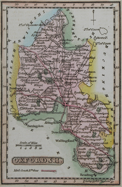
A characterful early-nineteenth century miniature map of Oxfordshire ornamented in original wash colour, originally engraved by James Wallis for a set of cartographical cards of the counties of England and Wales. The maps were subsequently republished as a pocket atlas called 'The Panorama of England and Wales.' Stylistically, Wallis' maps are very similar to, and often confused with, a near contemporaneous set engraved by Thomas Crabb, which were also reused in pocket atlases published by William Darton. The main point of difference is the deliberate demarcation of the Mail Coach roads on the Wallis maps. James Wallis (fl.1810-1825) was a London-based engraver, mapmaker, stationer, and bookseller. Aside from an apprenticeship under John Roper, and a stint in debtor's prison, not much is known of his life, and he is frequently confused with publisher James Wallis of Paternoster Row, and another James Wallis of Fleet St who was a jeweller and sometimes engraver. Condition: Binders chips and creases to right edge of sheet. Minor time toning to margins. Blank on verso. |
| Framing | unmounted |
| Price | £50.00 |
| Stock ID | 49782 |