
| Method | Copper engraved with hand colour |
| Artist | Kitchin, Thomas |
| Published | By T. Kitchin Geog. [London, c. 1798] |
| Dimensions | 152 x 205 mm |
| Notes |
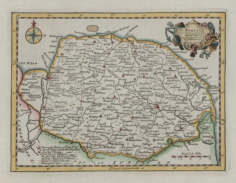
A mid-eighteenth century map of the county of Norfolk, from Francis Grose's A new and Complete Abridgment or Selection of the Most Interesting and Important Subjects in the Antiquities of England and Wales. These maps were first issued in The London Magazine from 1746-1760. A key at the lower left of the map provides details of Borough Towns, Market Towns, the road network, parishes, and villages. In the top right the title is enclosed in a decorative cartouche. Thomas Kitchin (1718-1784) was one of the best and most prolific engravers of the eighteenth century. He issued The General Atlas, Describing the Whole Universe, first published in 1773, and regularly reissued thereafter. His work also included a large number of maps of the English counties, particularly for the London Magazine (1747-1760), the Universal Magazine (1747-1766), and for Dodsley's England Illustrated (1764). Other maps were published in conjunction with Emanuel Bowen in the Large English Atlas and the Royal English Atlas (1763). Condition: Light time toning to edges of sheet. Blank on verso. |
| Framing | unmounted |
| Price | £100.00 |
| Stock ID | 52127 |