
| Method | Copper engraved with hand colour |
| Artist | Ortelius, Abraham |
| Published | Cum Privilegio [c. 1600] |
| Dimensions | 362 x 247 mm |
| Notes |
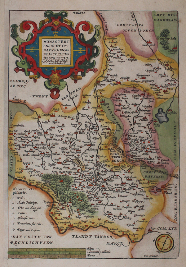
A regional map of Germany, illustrating the Münsterland area. From an edition of Ortelius' 'Theatrum Orbis Terrarum'. Map includes parts of Lower Saxony, between Oldenburg and the Lippe river. In the west to Bocholt, in the east to Diepholz. With Münster in the centre. Rivers, lakes, hills and forests have been included in lovely detail, and notable towns have been picked out in red. A key is included to the lower left and a compass to lower right. Title in a highly elaborate strapwork cartouche. Abraham Ortelius (1527 -1598) was a Flemish cartographer, cosmographer, geographer and publisher and a contemporary of Gerard Mercator, with whom he travelled through Italy and France. Although it is Mercator who first used the word "Atlas" as a name for a collection of maps, it is Ortelius who is remembered as the creator of the first modern atlas. 'Theatrum Orbis Terrarum' was the first systematically collated set of maps by different map makers in a uniform format. Three Latin editions as well as a Dutch, French and German edition of 'Theatrum Orbis Terrarum' were published by 1572 and a further 25 editions printed before Ortelius' death in 1598. Several more were subsequently printed until around 1612. Ortelius is said to have been the first person to pose the question of the continents once being a single land mass before separating into their current positions. Condition: Tear repairs to lower margin. Surface dirt, foxing and time toning. Printers crease to top left margin. |
| Framing | unmounted |
| Price | £175.00 |
| Stock ID | 45541 |