
| Method | Copper engraved with hand colour |
| Artist | Chatelain, Zacharie |
| Published | [Amsterdam, 1743] |
| Dimensions | 135 x 170 mm |
| Notes |
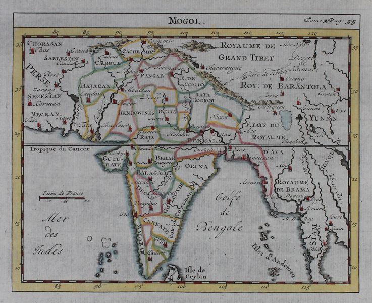
A miniature map of the Indian subcontinent encompassing parts of modern day Pakistan and Afghanistan, as well as neighbouring parts of modern day Persia, Tibet, China, Bangladesh, Burma (Myanmar) and Thailand (Siam), from the French encyclopaedia La Science des Personnes de Cour d'Epee et de Robe. The provinces of India are outlined in hand colour, and principal cities are picked out in red. Part of Sri Lanka appears at the bottom of the map, and the Andaman Islands and the northern Maldives are also shown. Zacharie Chatelain was the name of both the father and younger brother of the much better known Henri Abraham Chatelain (1684 - 1743), a Dutch cartographer of Parisian origins, who lived and worked in St. Martins, London (c. 1710), The Hague (c. 1721), and Amsterdam (c. 1728). Henri Abraham is best known for the seminal seven volume Atlas Historique (published in Amsterdam, 1705 - 20) which combined maps and topography with scholarly studies of geography, history, ethnology, heraldry, and cosmography. The Atlas was a family undertaking, managed by Henri along with his father and brother, and going through a number of editions. The majority of the maps for the work were engraved by Henri after charts by De L'Isle. After Henri's death, the younger Zacharie seems to have inherited the family publishing business, and issued a number of later editions in his own name. Condition: Vertical fold as issued. |
| Framing | unmounted |
| Price | £80.00 |
| Stock ID | 47143 |