
| Method | Steel engraved with original hand colour |
| Artist | Wyld, James |
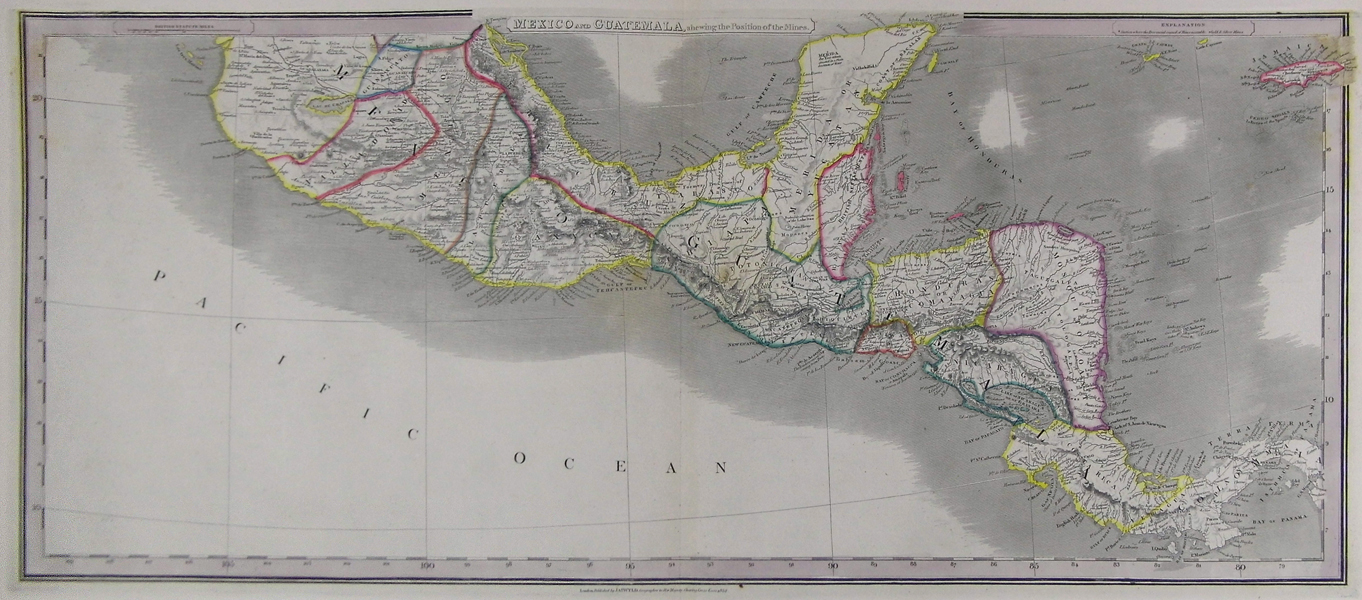
| Published | London. Published by Jas. Wyld, Geographer to Her Majesty, Charing Cross East 1852. [1854] |
| Dimensions | 345 x 790 mm |
| Notes |
Beautifully detailed map of Mexico and Guatemala, showing the locations of the gold and silver mines. From James Wyld's A New General Atlas of Modern Geography. The map extends from the southern half of Mexico to Panama and includes the Grand Cayman, Little Cayman, and Jamaica. The map is filled with detail, including political boundaries, place names, rivers, and topography shown by hachure. Nicaragua is divided into two, with the larger eastern portion labelled Mosquito Coast. Panama is also called Colombia, and British Settlements are noted along the coast of present-day Belize. James Wyld (1812-1887) was a British publisher and cartographer. His greatest geographical achievement was Wyld's Great Globe, exhibited in Leicester Square between 1851 and 1862. The globe, sixty feet high and lighted with gas, was at that point the largest ever constructed. He was geographer to Queen Victoria and H.R.H. Prince Albert. Condition: Centre fold, as issued. Some foxing at top, and slight offsetting in margins, not affecting image. |
| Framing | unmounted |
| Price | £175.00 |
| Stock ID | 41864 |