
| Method | Copper engraved with hand colour |
| Artist | [Crozat's Geography] |
| Published | [J. Ayne, Lyon, c.1795] |
| Dimensions | 140 x 270 mm |
| Notes |
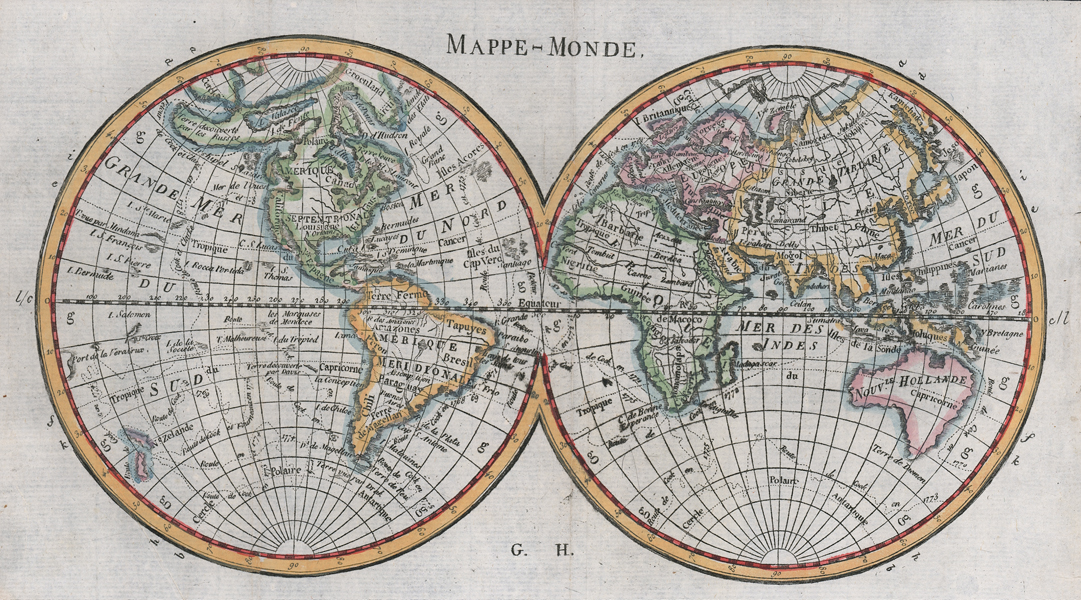
A late eighteenth century world map in two hemispheres, from 'Abrege de la Geographie de Crozat,' Ayne's abridgement of Crozat's Geography. The borders of each continent are outlined in hand colour and seacoasts are washed in blue. Cartographically the map has a number of quirks, including an elongated eastern Australia that encompasses Tasmania, a right angled orientation for Japan, and extensive lake, bay, and peninsula errors for the northwestern coasts of North America. Condition: Vertical and horizontal folds, as issued. Minor creasing and small chips to edges of sheet, not affecting map. |
| Framing | mounted |
| Price | £200.00 |
| Stock ID | 52562 |