
| Method | Copper engraved with hand colour |
| Artist | Chatelain, Henri Abraham |
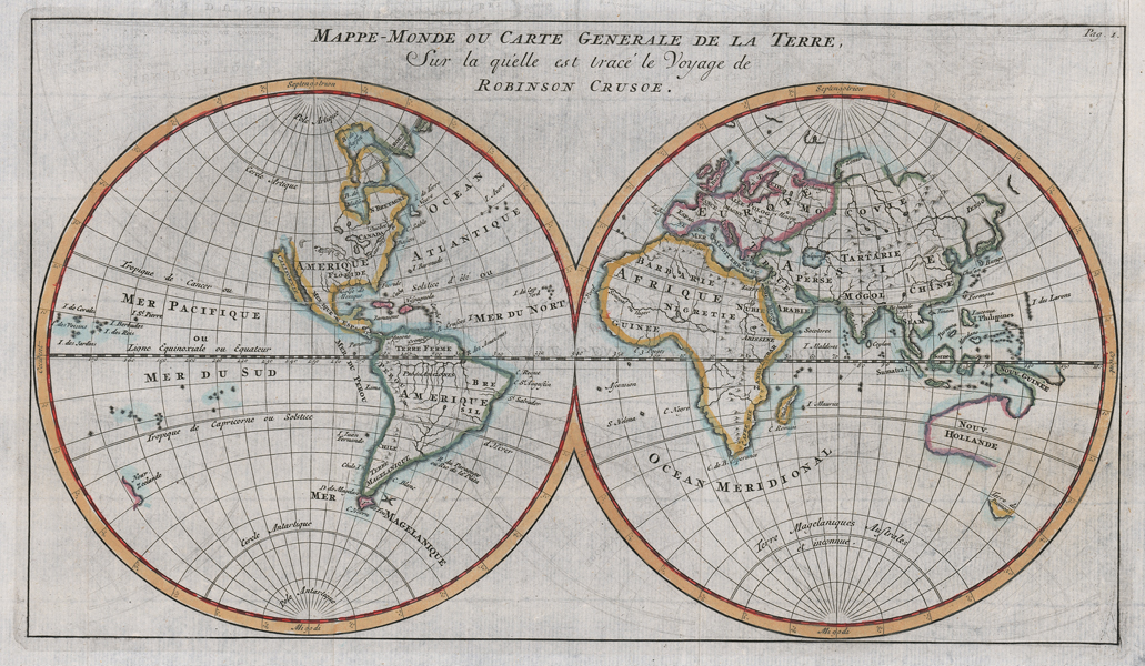
| Published | L'Honore & Chatalain, Amsterdam, 1727. |
| Dimensions | 175 x 310 mm |
| Notes |
An uncommon double hemisphere map from the French edition of The Surprising Life and Adventures of Robinson Crusoe by Daniel Defoe. The map shows incomplete mapping of both North America and Australia, with California depicted as an island. The map also shows the journey that Robinson Crusoe takes throughout his adventures, with the fictional Robinson Crusoe Island depicted just north of South America in the Caribbean Sea. Henri Abraham Chatelain (1684-1743) was a Dutch cartographer of Parisian origins, who lived and worked in St. Martins, London (c. 1710), The Hague (c. 1721), and Amsterdam (c. 1728). He is best known for the seminal seven volume Atlas Historique (published in Amsterdam, 1705 - 20) which combined maps and topography with scholarly studies of geography, history, ethnology, heraldry, and cosmography. The Atlas was a family undertaking, managed by Henri and his father, Zacharie, and going through a number of editions. The majority of the maps for the work were engraved by Henri after charts by De L'Isle. Condition: Vertical and horizontal folds as issued. |
| Framing | mounted |
| Price | £275.00 |
| Stock ID | 52557 |