
| Method | Copper engraved with hand colour |
| Artist | Robert de Vaugondy, Gilles |
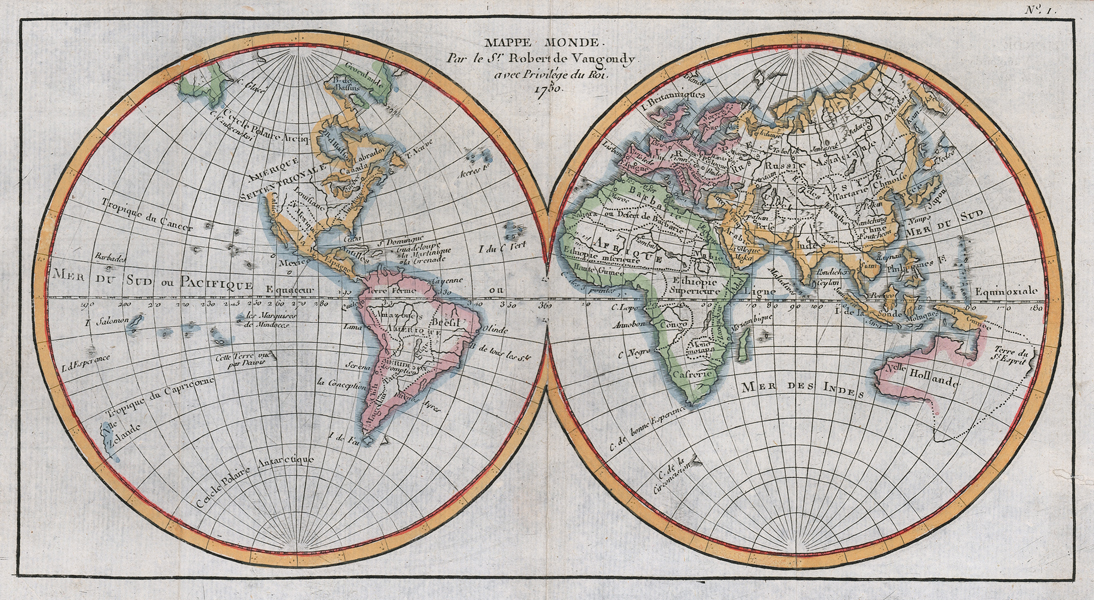
| Published | Par le Sr. Robert de Vaugondy. Avec Privilege du Roi. 1750. |
| Dimensions | 145 x 279 mm |
| Notes |
A mid-eighteenth century map of the world in two hemispheres, engraved in 1750. Much of the arctic is still unmapped, particularly the northwestern coast of North America, as well as the eastern coast of Australia and Papua New Guinea. The coasts and borders of the continents are outlined in hand colour, and basic regional divisions and putative coastlines are marked as dotted lines. Gilles Robert de Vaugondy (1688-1766) and his son Didier (1723-1786) were French cartographers, publishers, and globe-makers, responsible for the publication of the Atlas Universel (1757), one of the most significant cartographical achievements of the 18th century. The de Vaugondy family were descendants of the cartographer Nicholas Sanson d'Abbeville, and inherited many of his plates. These were reissued with updated astronomical observations and corrected longitudinal and latitudinal information in the Atlas Universel. Didier continued reissuing the Atlas after his father's death, and was appointed geographer to Louis XV later in life. Gilles often signed his maps simply as Sr. (or Sieur) Robert, whilst Didier usually used 'Robert de Vaugondy' as his signature, occassionally adding 'fils' to clearly distinguish himself from his father. Condition: Vertical folds, as issued. Repaired holes to right margin. Blank on verso. |
| Framing | mounted |
| Price | £200.00 |
| Stock ID | 52554 |