
| Method | Steel engraved with original hand colour |
| Artist | Wyld, James |
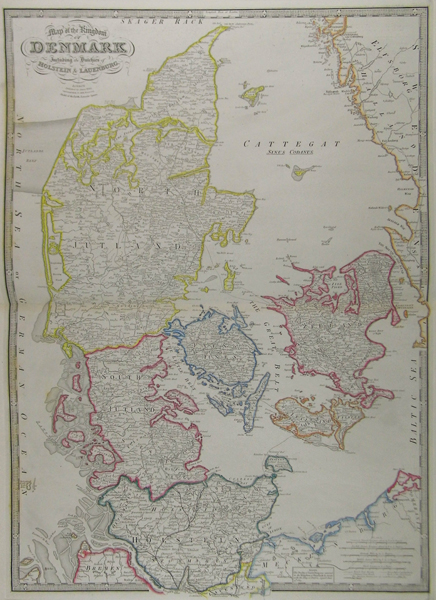
| Published | London. Published by James Wyld, Geographer to Her Majesty. Model of the Earth, Leicester Square. 1854 |
| Dimensions | 707 x 522 mm |
| Notes |
Detailed map of Denmark from James Wyld's A New General Atlas of Modern Geography. James Wyld (1812-1887) was a British publisher and cartographer. His greatest geographical achievement was Wyld's Great Globe, exhibited in Leicester Square between 1851 and 1862. The globe, sixty feet high and lighted with gas, was at that point the largest ever constructed. He was geographer to Queen Victoria and H.R.H. Prince Albert. Condition: Centre fold, as issued. Some discolouration in margins, not affecting image. |
| Framing | unmounted |
| Price | £175.00 |
| Stock ID | 41843 |