
| Method | Copper engraved with original hand colour |
| Artist | Duncan, Janmes |
| Published | London; Published by J. Duncan. Paternoster Row. [n.d. c. 1833] |
| Dimensions | 440 x 345 mm |
| Notes |
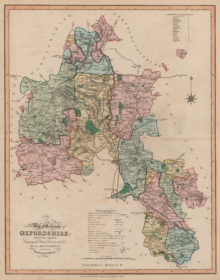
An uncommon map of the county of Oxfordshire, divided into Hundreds and ornated in original full wash colour outlining the division of the county following the Great Reform Act of 1832. From James Duncan's New Atlas of England and Wales, 1833. The highly detailed map demarks market towns and their distance from London, churches and chapels, mail, turnpike, travelling, and Rye roads, rivers, canals, parks and Gentlemen's Houses, all clearly labelled and referenced in an 'Explanation' table, along with a note of the number of members of Parliament from the county. A reference to the Hundreds, a compass rose and scale of miles surround the map. The maps for Duncan's New Atlas of England and Wales were prepared by William Ebden and engraved by Hoare & Reeves, they were originally published as loose sheets between 1824 and 1828 by William Cole, S. Maunder, and Hodgson & Co. from 10 Newgate Street, London. Condition: Time toning to sheet and some offsetting of text onto the sheet. |
| Framing | unmounted |
| Price | £200.00 |
| Stock ID | 52677 |