
| Method | Steel engraved with hand colour |
| Artist | Williams, W. |
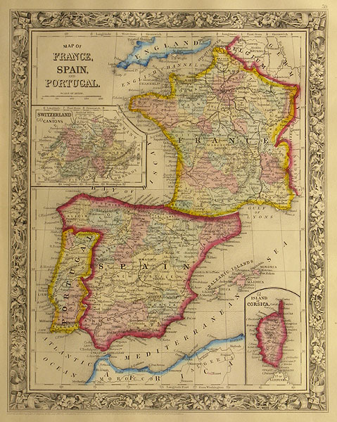
| Published | Philadelphia: Published by S.Augustus Mitchell, Jr. No.31 South Sixth Street, 1861. |
| Dimensions | 335 x 272 mm |
| Notes |
A nineteenth century American map of France, Spain, and Portugal ,from Mitchell's New General Atlas, Containing Maps of the Various Countries of the World. The three nations are divided into their constituent provinces, which are presented in full wash colour. In the bottom right, an inset map shows the French island of Corsica, while another inset map below the title shows the cantons of Switzerland. The map is enclosed in one of Mitchell's distinctive ornate borders, featuring ribbons and floral emblems. Longitude is measured from Washington. Samuel Augustus Mitchell Snr. (1792 - 1868) was one of the leading American map publishers of the nineteenth century. Working as a teacher in Connecticut, Mitchell Snr. became dissatisfied with the quality of school text books, and moved to the publishing centre Philadelphia to issue A New American Atlas (1831) from existing plates. He also began working with J. H. Young, the main compiler, draftsman and engraver for the Mitchell company until c.1860. Early pioneers of steel engraving, the Mitchell Company published Tanner's New Universal Atlas (1846 - 59), Mitchell's New General Atlas (1860 - 93), Mitchell's School Atlas (1839-1886) and Mitchell's Ancient Atlas, Classical and Sacred (1844 - 74). The firm was continued by Samuel Augustus Mitchell Jnr. until the 1890s. |
| Framing | unmounted |
| Price | £45.00 |
| Stock ID | 26898 |