
| Method | Offset Lithograph |
| Artist | Blair, R. Baxter with Samuel B. Harding |
| Published | Published by Denoyer- Geppert Co., Chicago, 1953 |
| Dimensions | 770 x 1080 mm |
| Notes |
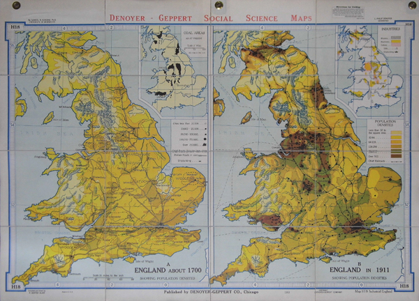
A folding map with two large maps of England and Wales showing populagtion densities in 1700 and in 1911 side by side with smaller inset maps one showing the coal area and one showing the locations of different types of industries. Dissected into 12 seats and laid to linen. Each sheet 208 x 273 mm. Scale 16 miles to the inch. Complete with original cloth and card boards. Denoyer-Geppert Co. are manufacturers and distributors of teaching tools, including maps, for education. Condition: Excellent. |
| Framing | unmounted |
| Price | £200.00 |
| Stock ID | 33705 |