
| Method | Copper engraved with hand colour |
| Artist | Mallet, Alain Manesson |
| Published | [Denys Thierry, Paris, c.1683] |
| Dimensions | 140 x 100 mm |
| Notes |
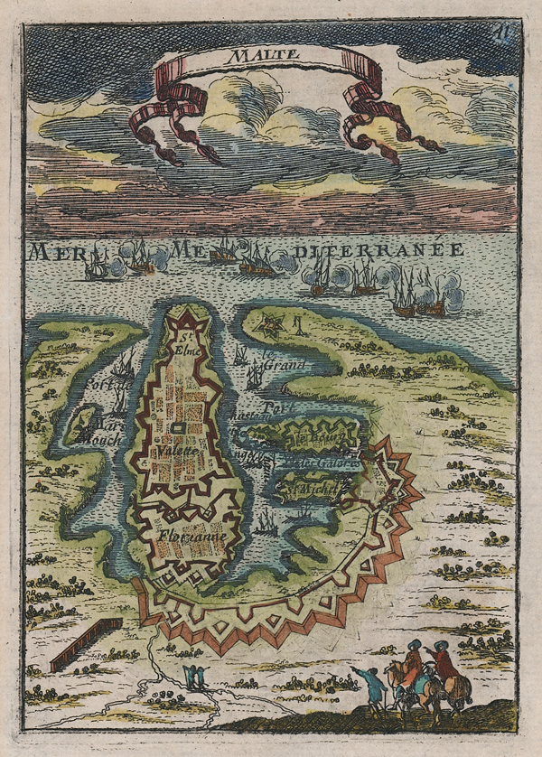
A small late-seventeenth century map of Valetta, Malta, from the third volume of Mallet's Description de l'Univers. The city plan, embellished in hand colour, is shown in a stylised birds-eye perspective, with a group of travellers on a rocky outcrop in the foreground looking down at the celebrated walled city, and its associated forts and ports. In the distance, a naval battle takes place on the waters of the Mediterranean. The title is enclosed in a ribboned banner at the top of the plate. Alain Manesson Mallet (1630–1706) was a French cartographer and engineer. He started his career as a soldier in the army of Louis XIV, became a Sergeant-Major in the artillery and an Inspector of Fortifications. He also served under the King of Portugal, before returning to France and his appointment to the court of Louis XIV. His military engineering and mathematical background led to his position teaching mathematics at court. Mallet's major publications were Description de L'Univers (1683) in five volumes, and Les Travaux de Mars ou l'Art de la Guerre (1684) in three volumes. Condition: Minor time toning to edges of sheet. Repaired tear to top margin, not affecting plate. French text above and on verso. |
| Framing | unmounted |
| Price | £200.00 |
| Stock ID | 52001 |