
| Method | Copper engraved with hand colour |
| Artist | Hondius, Jodocus the Younger |
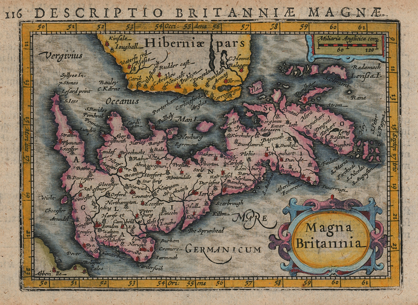
| Published | [Amsterdam, c.1616] |
| Dimensions | 96 x 135 mm |
| Notes |
A miniature map of the British Isles, engraved by Jodocus Hondius the Younger for the 1616 printing of Bertius' Tabularum Geographicarum Contractarum. The map, a reduction of the Atlas Minor map of the same region, was part of a suite of maps intended to replace and update an earlier series of miniature maps engraved by Hondius' uncle, Pieter van den Keere. King suggests that this map, along with the other four plates of the British Isles, were engraved for Hondius by Salomon Rogiers, rather than engraved by Hondius himself. Jodocus Hondius the Younger (1594-1629) was a Dutch Flemish cartographer, engraver, and publisher, and the son of the famous geographer Jodocus Hondius the Elder. With his brother, Henricus, and his mother Coletta, the sister of Pieter van den Keere, Jodocus took over the family printing business upon the death of his father in 1612. Although not as prolific an engraver as his father or brother, Jodocus still produced an impressive oeuvre of cartographic works. Chief amongst them are a series of over 200 miniature maps he engraved in 1616 for later editions of Bertius' Tabularum Geographicarum Contractarum. It seems that Jodocus and his brother Henricus fell out over the running of the family business, and upon his death in 1629, his own plates were sold to Willem Blaeu, the family's key competitor. Petrus Bertius (14th November 1565 – 13th October 1629) was a Flemish theologian, historian, geographer and cartographer and was related to Jodocus Hondius Sr. and Pieter van den Keere by marriage. Bertius studied at the University of Leiden and later traveled in Germany and Russia. In 1620 he emigrated to France where he was appointed as a cosmographer to the court Louis XIII. Bertius published a number of folio maps, but never published an atlas of his own. His maps were either separately published or included in atlases and books by other publishers. Pieter van den Keere, also known frequently as Petrus Kaerius, came to England in 1584, as a Protestant refugee from his home town of Ghent with his sister Colette, who married Jodocus Hondius, in 1587. It was probably from Hondius that Keere learned to engrave. Both engravers left London in 1593 to settle in Amsterdam. His first set of miniature maps were produced for the Middelburg publisher Cornelis Claesz, for inclusion in Barent Langenes' Caert Thresoor. Keere began to engrave a series of miniature maps in 1599 in preparation for a small atlas of the British Isles. The maps were first published in 1617 by William Blaeu with plate numbers and Latin text. They then passed to George Humble, who published them in 1619 and then again in 1627, by which time they had become known colloquially as 'Miniature Speeds.' Condition: Toning to margins, not affecting image. Latin text on verso. |
| Framing | mounted |
| Price | £300.00 |
| Stock ID | 51944 |