
| Method | Copper engraved with hand colour |
| Artist | André after Bonne, Rigobert |
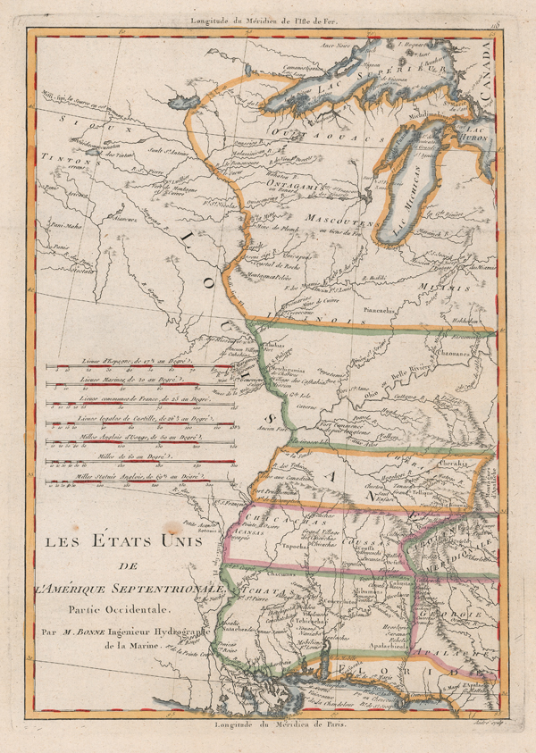
| Published | Par M. Bonne Ingenieur Hydrographe de la Marine [1783] |
| Dimensions | 355 x 235 mm |
| Notes |
A French map of the Mississippi, published in the final year of the American Revolutionary War, from Raynal's Atlas de toutes les parties connues du Globe Terrestre dress pour l'Histoire Philosophique & Politique des Etablissemens & du Commerce des Europens dans les deux Indes. The map, stretching from the Great Lakes to the Gulf of Mexico, shows the eastern parts of the fledgling United States, as well as the extent of the French colony of Louisiana. State boundaries are picked out in different hand coloured outlines and a scale above the title shows distances in French and English miles. A major cartographer of the late 18th century, Rigobert Bonne (1727-1795) was Royal Cartographer to France, succeeding Jacques Nicolas Bellin in the office of the Hydrographer at the Depôt de la Marine. Bonne produced some of the most detailed and precise maps of the period. Bonne's maps represent a departure from the more decorative maps of the previous century, and although much of his cartographic style can be traced to his predecessor, Bellin, Bonne maps are generally less decorative, characteristically lacking ornate cartouches, compass roses, or contemporary hand colour. Condition: Horizontal folds, as issued. Binders holes to bottom margin, not affecting map. Blank on verso. |
| Framing | unmounted |
| Price | £200.00 |
| Stock ID | 52154 |