
| Method | Copper engraved with hand colour |
| Artist | Kitchin, Thomas |
| Published | [London, c. 1798] |
| Dimensions | 168 x 215 mm |
| Notes |
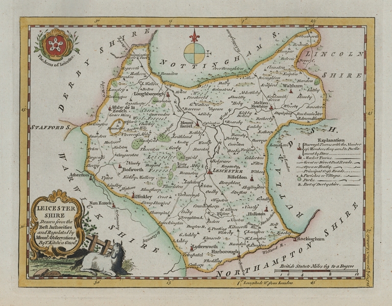
An attractive mid-eighteenth century map of the county of Leicestershire from Francis Grose's A new and Complete Abridgment or Selection of the Most Interesting and Important Subjects in the Antiquities of England and Wales, with the arms of Leicester, a compass rose, and decorative cartouche. These maps were first issued in The London Magazine from 1746-1760. A key in the right provides details of Borough Towns, Market Towns, the road network, parishes, and villages. In the bttom left, the title is enclosed in a decorative cartouche, and the arms of Leicester are included in the bottom right corner of the plate. Thomas Kitchin (1718-1784) was one of the best and most prolific engravers of the eighteenth century. He issued The General Atlas, Describing the Whole Universe , first published in 1773, and regularly reissued thereafter. His work also included a large number of maps of the English counties, particularly for the London Magazine (1747-1760), the Universal Magazine (1747-1766), and for Dodsley's England Illustrated (1764). Other maps were published in conjunction with Emanuel Bowen in the Large English Atlas and the Royal English Atlas (1763). |
| Framing | mounted |
| Price | £100.00 |
| Stock ID | 52066 |