
| Method | Copper engraved |
| Artist | Bonne, Rigobert |
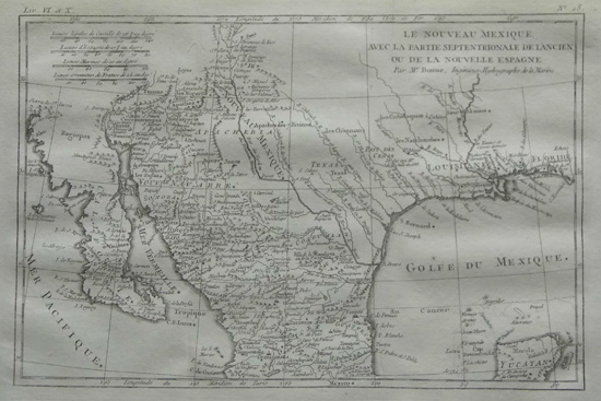
| Published | Paris, 1780 |
| Dimensions | 209 x 315 mm |
| Notes |
An attractive 18th century map covering the area from western Florida through Louisiana, Texas, New Mexico, Arizona, and northern Mexico. Names of Jesuit missions and Indian Tribes are illustrated along with the date and location of La Salle's death. From Raynal's Atlas de toutes les parties connues du globe terrestre. A major cartographer of the late 18th century, Rigobert Bonne (1727-1795) was Royal Cartographer to France, succeeding Jacques Nicolas Bellin in the office of the Hydrographer at the Depôt de la Marine. Bonne produced some of the most detailed and precise maps of the period. Bonne's maps represent a departure from the more decorative maps of the previous century, and although much of Bonne's cartographic style can be traced to his predecessor, Bellin, Bonne maps are generally less decorative, characteristically lacking ornate cartouches, compass roses, or contemporary hand colour. |
| Framing | unmounted |
| Price | £250.00 |
| Stock ID | 33935 |