
| Method | Copper engraved with hand colour |
| Artist | Lattré, Jean |
| Published | [Paris, c.1765] |
| Dimensions | 140 x 175 mm |
| Notes |
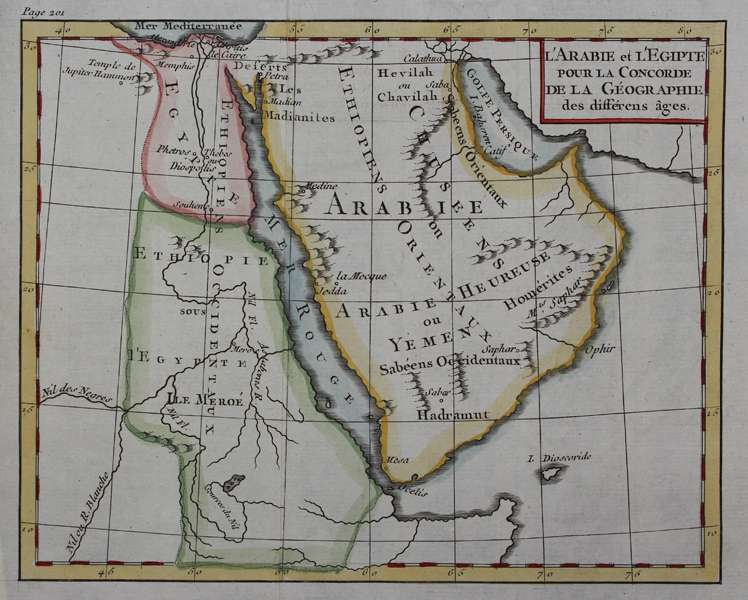
A small eighteenth century French map of the Arabian peninsula, Egypt, and Ethiopia, from Noel Antoine Pluche's 'Concorde de la Géographie des différents Ages'. The map is ornamented in beautiful wash and outline colour, and contains both ancient and modern geographical details. Jean Lattre (fl. 1743 - 1793) was an engraver, bookseller and map publisher who was active in Paris from the mid until late 18th century. He worked with French, Italian and English cartographers like Santini, Delamarche, Bonne and Faden. Noël-Antoine Pluche (1688 - 1761), also known as Abbé Pluche was a priest and a teacher of rhetoric. He gave up teaching for several years to write 'Spectacle de la nature'. The books are for the most part written in dialogues between a young man and his parents or a prior, reflecting Pluches's own experiences as a teacher and priest. Many subjects are tackled in these dialogues, from husbandry, the discovery of the roundness of the earth, animals and insects to the motions of the planets. Because of the dialogue form and the wide range of subjects, the books were mainly used for educational purposes. The publication was very successful and had around fifty-seven editions in France, seventeen in England and several more in other European countries. Condition: Vertical folds as issued. Minor creasing, particularly to folds. Blank on verso. |
| Framing | unmounted |
| Price | £85.00 |
| Stock ID | 48699 |