
| Method | Lithograph with hand colour |
| Artist | Weller, Edward |
| Published | London: Published at the "Weekly Dispatch" Office, 139, Fleet Street, London, and Sold by All Booksellers and Newsagents. 1863. |
| Dimensions | 650 x 450 mm |
| Notes |
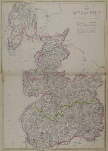
From The Dispatch Atlas. A large double sheet map of the county of Lancashire, with boundaries and railways marked. A small information panel below the title describes the area and parliamentary divisions of the counties. Between 1857 and 1863, the British newspaper The Weekly Dispatch published a series of maps. Over 100 maps were produced, and in 1863, the maps were gathered together to form The Dispatch Atlas. The atlas contained county and country maps, as well as several city maps. Each of the maps featured a distinctive image of a half-globe with a winged mercury above. Edward Weller, FRGS (d.1884) was an engraver, publisher and cartographer. He had premises in London at 34, Red Lion Square (1861) and Duke Street, Bloomsbury (1872). He often worked for George Philip and Son, and William Collins, Sons, & Co. Many of his maps were included in student atlases. Weller's business was continued by his wife Mary Anne (d.1887) and his son Francis Sidney (d.1910). Condition: Horizontal fold as issued. Light time toning and small tears to margins, not affecting map. Light ink staining and foxing to map. |
| Framing | unmounted |
| Price | £45.00 |
| Stock ID | 38786 |