
| Method | Copper engraved |
| Artist | Godin, Henri-Joseph |
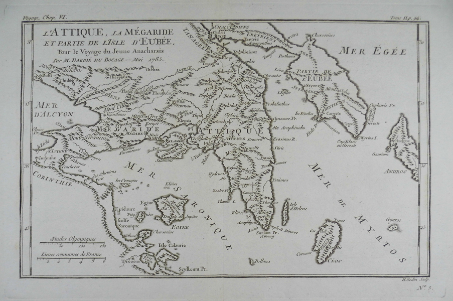
| Published | Par M. Barbie du Bocage. Mai 1785 |
| Dimensions | 172 x 273 mm |
| Notes |
A map of the ancient Greek territories of Attica and the Megarid, Plate 5 from the 1788 edition of Barbie du Bocage's Recueil de Cartes Geographiques Plans, Vues, et Medailles de l'Ancienne Grece, Reelatifs au Voyage du Jeune Anacharsis. The map depicts the extent of the regions controlled by the ancient city-states of Athens and Megara, as well as adjoining parts of Corinthia, Boeotia, Euboea, and the islands of Aegina, Keos (modern Kea), and Andros. The cities themselves are depicted as walled enclosures, and the famous Long Walls of Athens, leading to the Piraeus, are illustrated and labelled. The Recueil de Cartes Geographiques Plans, Vues, et Medailles de l'Ancienne Grece, Reelatifs au Voyage du Jeune Anacharsis was an atlas published by the Paris booksellers, printmakers, and engravers Jean Denis Barbie du Bocage to accompany Jean-Jacques Barthelemy's Voyage du jeune Anacharsis en Grèce dans le milieu du IVe siècle. The Voyage du jeune Anacharsis was an unusual work. Written as a sort of general guidebook to the cities, customs, and culture of classical Greece, it purported to be the work of the grandson of the Scythian philosopher Anacharsis, documenting his travels in Greece during the 4th century BC. This clever literary conceit allowed the real author, Barthelemy, to explore the history and society of Classical Greece in a manner that was informative, yet informal, aiming to appeal to a much broader audience than a traditional academic history. Barthelemy was a talented antiquarian, particularly in regards to the study of ancient numismatics, and although the content of his work contains numerous historical flaws, the Voyage du jeune Anacharsis was a huge success, appearing in numerous editions and reprints. Sadly Barthelemy received very little from his success, his aristocratic background marking him as a target for the Revolutionary government, who confiscated most of his wealth. Despite his economic hardships, the general public continued to hold him in high esteem, and the demand for his material on ancient Greece was the main motiv ation behind the publication in 1788 of the accompanying Atlas to the Voyage. The first edition of Barbie's Recueil contained 31 plates related to Barthelemy's text, including maps of cities and territories, plans of battles, religious sanctuaries, and public spaces, and illustrations of temples, theatres, and even coins. Henri-Joseph Godin (1747-1834) was a French painter, engraver, and printmaker. He worked on maps for a number of atlases, as well as portraits, architectural plans, and antiquarian subjects. Condition: Central vertical fold as issued. Minor time toning to central fold and edges of sheet. |
| Framing | unmounted |
| Price | £55.00 |
| Stock ID | 13269 |