
| Method | Copper engraved with hand colour |
| Artist | after Peeters, Jacques |
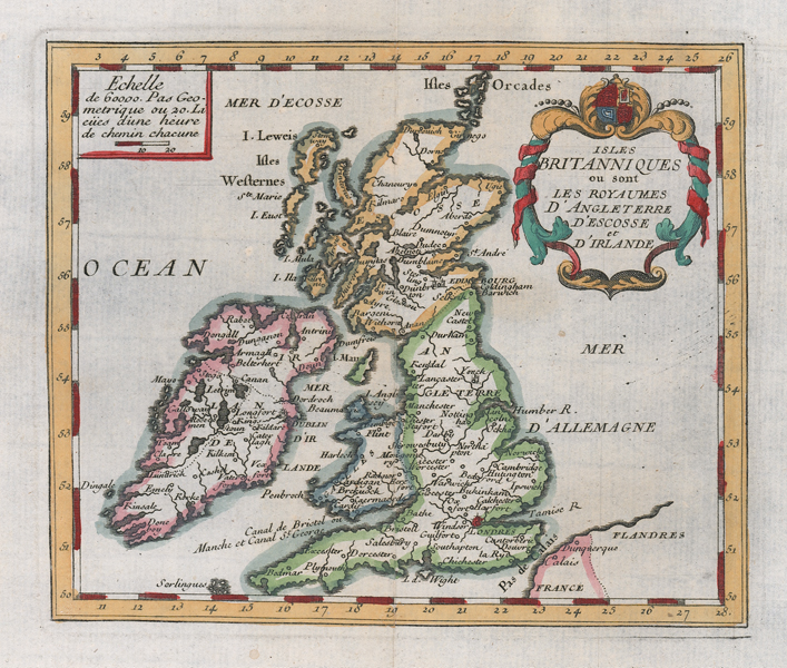
| Published | [Antwerp, 1739] |
| Dimensions | 130 x 155 mm |
| Notes |
An uncommon small scale French map of the British Isles, from a 1739 printing of Peeters' 'L'Atlas en Abrégé, ou Nouvelle Description du Monde.' The map shows the borders of Ireland, Scotland, Wales, and England outlined in hand colour, and with London picked out in red. The title is enclosed in a decorative baroque cartouche in the top right corner of the plate, and to the top left is a boxed scale in miles. Jacques Peeters (fl.1690s-1730s), also known as Jacob Pietersz, was a Flemish cartographer, engraver, and publisher. Condition: Central vertical fold, as issued. Blank on verso. |
| Framing | mounted |
| Price | £125.00 |
| Stock ID | 52564 |