
| Method | Steel engraved |
| Artist | Moule, Thomas |
| Published | [c.1845] |
| Dimensions | 199 x 248 mm |
| Notes |
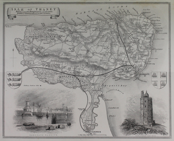
A decorative map of the Isle of Thanet, Kent. The map shows land divisions, principal towns and villages, and the railway branches from Canterbury and London to Sandwich, Ramsgate, and Margate. In addition to a pair of crests, the map also features vignettes of Ramsgate Harbour and the North Foreland Light House. Thomas Moule (1784-1851) was a British writer, engraver, cartographer, and antiquarian. Originally a writer on Heraldry and general antiquities, Moule was born in Marylebone, London. From around 1816 to 1823 he was a bookseller, from his shop in Grosvenor Square, London. He then became an inspector of letters in the General Post Office, where his responsibilities included trying to 'read' illegible hand writing. His highly decorative series of county maps were first published in separate issues for each county between 1830 and 1832. In 1836 these were brought together in one work, by George Virtue & Co. They continued to appear in Rev. Barclay's Dictionary into the 1840's. Condition: Trimmed within plate mark as issued. Printers holes along top margin. Minor damp staining to margins, not affecting map. |
| Framing | unmounted |
| Price | £65.00 |
| Stock ID | 48161 |