
| Method | Copper engraved |
| Artist | Bodenehr, Gabriel |
| Published | [Johann Philipp Andrea, Frankfurt-am-Main, 1702] |
| Dimensions | 68 x 80 mm |
| Notes |
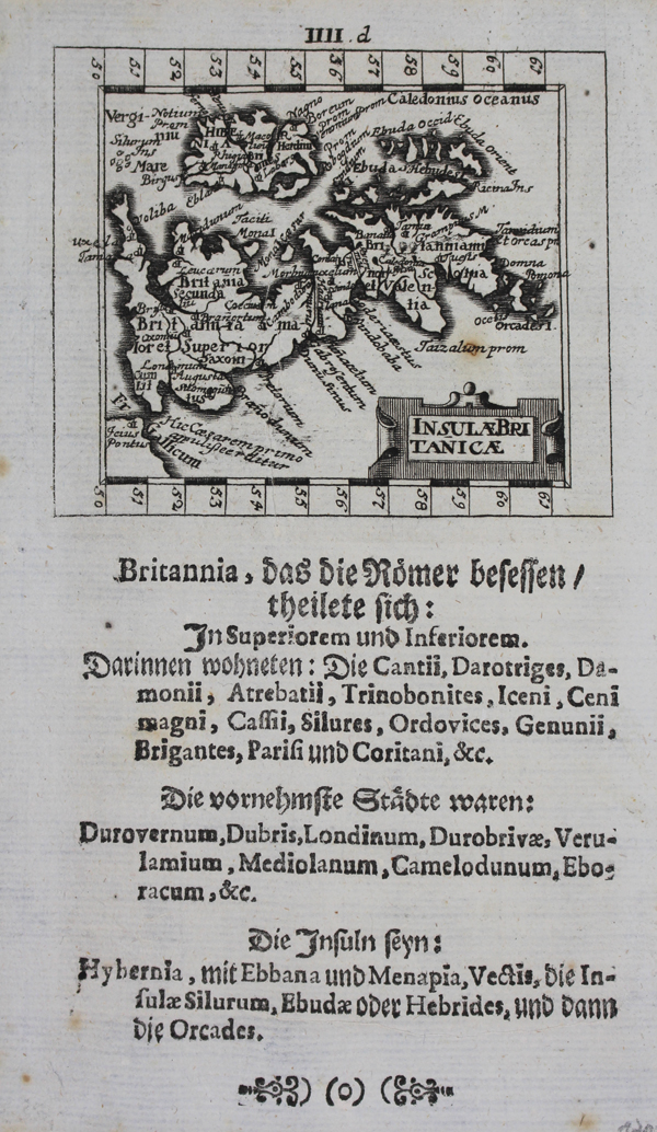
A finely engraved miniature map of the British Isles, oriented with West to top, originally engraved by Bodenehr for Johann Ulrich Muller's 1692 'Neu aussgeffertigter kleiner Atlas.' This impression is from the 1702 printing, published by Johann Andrea. The map is essentially antiquarian in outlook, presenting the places, cities, tribal divisions, and titles of the British isles during the Roman period. Hadrian's wall is shown as a set of parallel lines running across the north of England, and the Antonine Wall is here labelled the Severan Wall, a common attribution based on Septimius Severus' efforts to repair and refortify the boundary in AD 208. Above and below, the map's border is broken into degrees, while the title is enclosed in a small strapwork cartouche in the bottom right corner. Below the map, a section of letterpress in German and Latin lists the names of the ancient Celtic tribes resident in the British isles, the Roman names of principal cities, and the names of the various islands off the coast of the British Isles. Gabriel Bodenehr (1664-1758) was a German engraver, geographer, and publisher, and a scion of the Augsburg-based Bodenehr family of engravers. Condition: Minor foxing to left and bottom edges of sheet, not affecting map. |
| Framing | unmounted |
| Price | £220.00 |
| Stock ID | 46184 |