
| Method | Copper engraved with early hand colour |
| Artist | Weigel, Christoph |
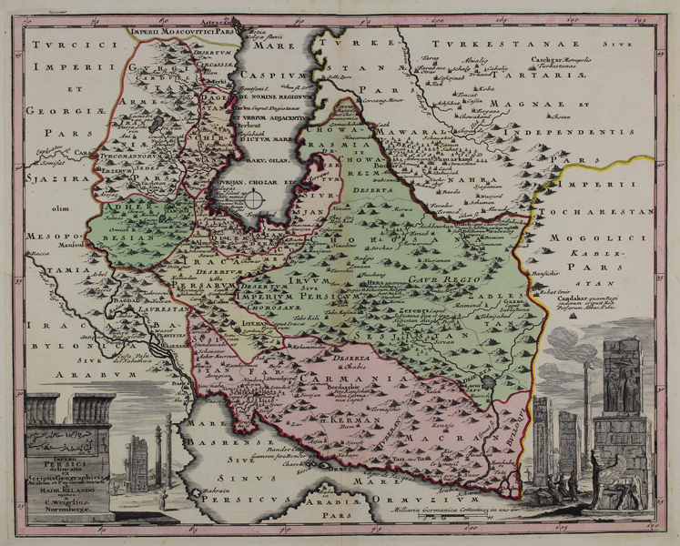
| Published | tentata ab Hadr. Relando, excusa a C. Weigelio Norimbergae. [Nuremberg, c.1718] |
| Dimensions | 330 x 405 mm |
| Notes |
A striking early eighteenth century map of Persia, from Christoph Weigel's relatively scarce Atlas scholasticus et itinerarius. The map credits the celebrated Dutch orientalist Adriaan Reland (1676-1718) in its title cartouche. The cartouche itself, and a vignette on the opposite bottom corner of the map, provides illustrations of the ruins of the ancient Achaemenid capital of Persepolis. The map itself is ornamented in beautiful early wash colour, with the boundaries of each territory outlined in pink. Christoph Weigel (1654-1725) was a German mapmaker, publisher, and art dealer, known mostly for his travel atlases. Condition: Central vertical fold as issued. Old framers tape to left and right margins, not affecting map. Blank on verso. |
| Framing | unmounted |
| Price | £350.00 |
| Stock ID | 48606 |