
| Method | Copper engraved with hand colour |
| Artist | Cluver, Philipp |
| Published | [London, c.1712] |
| Dimensions | 200 x 252 mm |
| Notes |
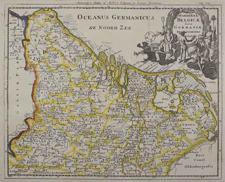
A map of Belgium and the Netherlands, from an early eighteenth century printing of Philipp Cluver's Introductio in Universam Geographicam. The map is oriented with west to top. The borders of each of the Belgian and United Provinces are outlined in yellow, and the adjoining borders of France and Germany are also outlined in hand colour. In the top right corner, the title is flanked by numerous allegorical figures, alluding to the successes of Dutch seafaring, commerce, and warfare. Retitled in English along top margin: Cluverius's Mapp of Modern Belgium, or Lower Germany. Philipp Cluver (1580-1622) was born in Danzig and after studying at Leyden and Oxford, he became interested in modern and historical geography. His subsequent publications made a wide and influential contribution to knowledge of the subject. Philip Cluver's "Introductonius" was a popular geography book, first published in 1624 without maps. There were many editions throughout the 17th and 18th centuries with maps from several sets of plates. Condition: Vertical folds as issued. Rust marks on bottom margin. Blank on verso. |
| Framing | unmounted |
| Price | £100.00 |
| Stock ID | 48842 |