
| Method | Copper engraved with hand colour |
| Artist | Wallis, James |
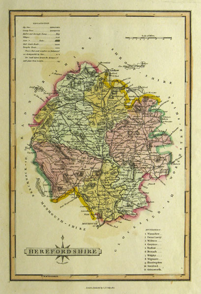
| Published | London Publish'd by S.A. Oddy, 1812 |
| Dimensions | 247 x 350 mm |
| Notes |
James Wallis was an engraver and publisher who resided at 77 Berwick Street, Soho, London. Wallis' engraved work includes, amongst other publications, S. A. Oddy's New General Atlas of the World, 1811, Wallis's New Pocket Edition of the English Counties or Travellers Companion..., 1812, Ellis's New and Correct Atlas of England and Wales..., 1819 and The Panorama or Traveller's Instructive Guide through England and Wales, 1820. This map derives from Wallis's New British Atlas containing a complete set of county maps which was reissued in 1812. Condition: Trimmed, but well outside of the platemark. Contains a few spots of foxing but the image is unaffected. |
| Framing | unmounted |
| Price | £35.00 |
| Stock ID | 28292 |