
| Method | Steel engraved with hand colour |
| Artist | Hughes, William |
| Published | London: Hall, Virtue & Co. 25 Paternoster Row. 1851. |
| Dimensions | 175 x 120 mm |
| Notes |
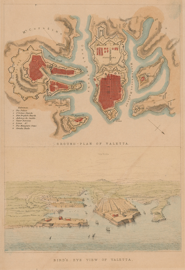
A pair of mid-nineteenth century plans of Valetta, Malta, from Bartlett's 'Gleanings, Pictorial and Antiquarian, on the Overland Route.' At top, a city plan of Valetta provides a view of the grid-pattern of its streets, as well as the various forts, fortifications, harbours, and ports. A numerical key in the bottom left provides details of the City's churches and buildings. Below, a vignette provides a bird's-eye view of Valetta from the waters of the Mediterranean. In the distance, Mdina is labelled 'Citta Vecchia' (Old Town). William Hughes (c.1818-1876) was a British geographer, engraver, and publisher, and a fellow of the Royal Geographical Society. He produced maps for a number of atlases and publishers, including Black's General Atlas, George Philip's Imperial General Atlas, Charles Knight, and George Virtue. In addition to his work as an engraver, he was also worked as a professor of Geography at St John's College Battersea and King's College, as well as a cataloguer of cartographic material for the British Museum. William Henry Bartlett (1809-1854) was a British landscape artist famous for his views of all parts of the world, which appeared in a series of travel volumes issued in the nineteenth century. Condition: Light toning from old mount to margins, not affecting map. Old adhesive tape on verso, otherwise blank. |
| Framing | unmounted |
| Price | £125.00 |
| Stock ID | 52003 |