
| Method | Offset lithograph |
| Artist | Chias y Carbo, Benito |
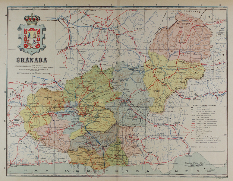
| Published | Benito Chias Yng. Alberto Martin Editor Barcelona. S. Poch Go. [Barcelona, c.1915] |
| Dimensions | 340 x 430 mm |
| Notes |
A map of the Spanish province of Grenada, designed by Benito Chias for the Atlas Geográfico de España. The map divides the province into its various regions, each presented in full decorative colour. Roads and railways crisscross the map, in red and black-and-white respectively, and rivers and mountains are also shown. In the top left corner, the crest of Grenada is included above the scale, and a key is included in the bottom right. Benito Chias y Carbo (fl. c.1900-1930) was a Spanish author, geographer, mapmaker, and military engineer, best known as the creator of numerous maps and atlases published in conjunction with the Barcelona-based editor and publisher Alberto Martin. The success of his Atlas Geográfico de España led to it being authorised and reprinted numerous times as an educational aid by the Spanish Ministry of Public Instruction and Fine Arts. Condition: Central vertical fold as issued. Time toning to edges of sheet. Minor tears, chips, and creasing to margins, not affecting map. Manuscript line in blue passing to the right of the city of Grenada. Spanish text on verso. |
| Framing | unmounted |
| Price | £70.00 |
| Stock ID | 48857 |