
| Method | Copper engraved with hand colour |
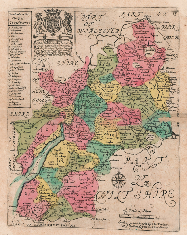
| Artist | Blome, Richard |
| Published | London, printed & Sold by Tho. Taylor, at ye Golden Lyon in Fleet Street [c.1715] |
| Dimensions | 245 x 190 mm |
| Notes |
Blome's uncommon and untitled small scale map of the county of Gloucestershire, from his small county atlas 'Speed's Maps Epitomiz'd. The dates given on the maps in this series suggest they were engraved before Blome's better known county maps from his 1673 Britannia atlas, though were not published until a decade later. Following Blome's death, the plates from 'Speed's Maps Epitomiz'd were acquired by Thomas Taylor, who reissued them with minor revisions in his England Exactly Described, first appearing in 1715. In the 1730s, they were again reissued by Thomas Bakewell. This particular example is the Thomas Taylor printing. Richard Blome was one of the most active map-publishers of his day, working between about 1667 and 1705. His principal publications were the 'Geographical Description of the World', and two county atlases, the 'Britannia', published in 1673, and 'Speed's Maps Epitomiz'd', published in 1681. Blome first began engraving maps for his Geographical Description Of The Four Parts Of The World in 1667. The completed volume was in small folio, and contained 24 maps (plus one duplicated), engraved by Francis Lamb, Thomas Burnford, and Wenceslaus Hollar. Blome has been heavily criticised as a plagiarist, but he lacked the capital to be innovative (as indeed did virtually all his contemporaries), and his output filled an important gap in the market. The 'Geographical Description' was the first new, and uniformly assembled, folio world atlas to be published in London since 1627, while the next folio world atlases appeared in the decade 1710-1720. Condition: Central horizontal fold, as issued. Insect damage to right hand side of central fold, now infilled. Tipped to old mount card at corners. |
| Framing | unmounted |
| Price | £100.00 |
| Stock ID | 51645 |