
| Method | Copper engraved with hand colour |
| Artist | Neele, Samuel John |
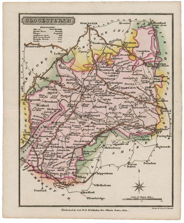
| Published | Neele & Son Sc. Strand. Published by G. & W.B. Whittaker, Ave-Maria Lane, 1821. |
| Dimensions | 165 x 130 mm |
| Notes |
A small-scale map of the county of Gloucestershire, originally engraved by Henry Cooper for Benjamin Pitts Capper's 'A Topographical Dictionary of the United Kingdom.' The plates were subsequently reused by Neele and Son for The Traveller's Pocket Atlas of 1821, and also for Pinnock's County Histories, before being bought and reissued in later impressions of both works by the Whittakers. Considering its small size, the map is relatively detailed, outlining the county boundaries are divisions of the Hundreds, as well as the roads, canals, and rivers of the county. Henry Cooper (fl.1804-1819) was a London-based engraver and mapmaker. Samuel John Neele (1758-1824) headed a family of engravers and publishers mainly working from 352 Strand, London. He worked on numerous publications throughout his lifetime trading with his younger brother George as "S. & G. Neele" from 1813 to 1814, and with his son, James as "Neele and Son" from 1816 to 1824. Condition: Central horizontal fold, as issued. Minor time toning to margins. Blank on verso. |
| Framing | unmounted |
| Price | £45.00 |
| Stock ID | 51632 |