
| Method | Copper engraved |
| Artist | Cluver, Philipp |
| Published | c. 1660 |
| Dimensions | 265 x 351 mm |
| Notes |
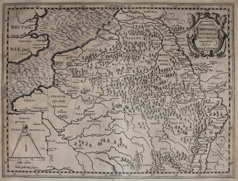
A map of the Low Countries and part of Germany, depicting its ancient tribes in the Rhine basin, Schelde, Mosel and Maas River valleys. Forests and hills well presented. Title flanked by two grotesque bearded caryatids, likely representing river gods. Scale illustrated with a large compass. Philip Cluver (1580-1622) was born in Danzig and after studying at Leyden and Oxford, he became interested in modern and historical geography. His subsequent publications made a wide and influential contribution to knowledge of the subject. Philip Cluver's "Introductonius" was a popular geography book, first published in 1624 without maps. There were many editions throughout the 17th and 18th centuries with maps from several sets of plates. Condition: Time toning, some paper wear and surface marking. Tears to margins. Central vertical fold, as issued. |
| Framing | unmounted |
| Price | £100.00 |
| Stock ID | 45455 |