
| Method | Copper engraved with hand colour |
| Artist | Cluver, Philipp |
| Published | [c. 1631] |
| Dimensions | 263 x 348 mm |
| Notes |
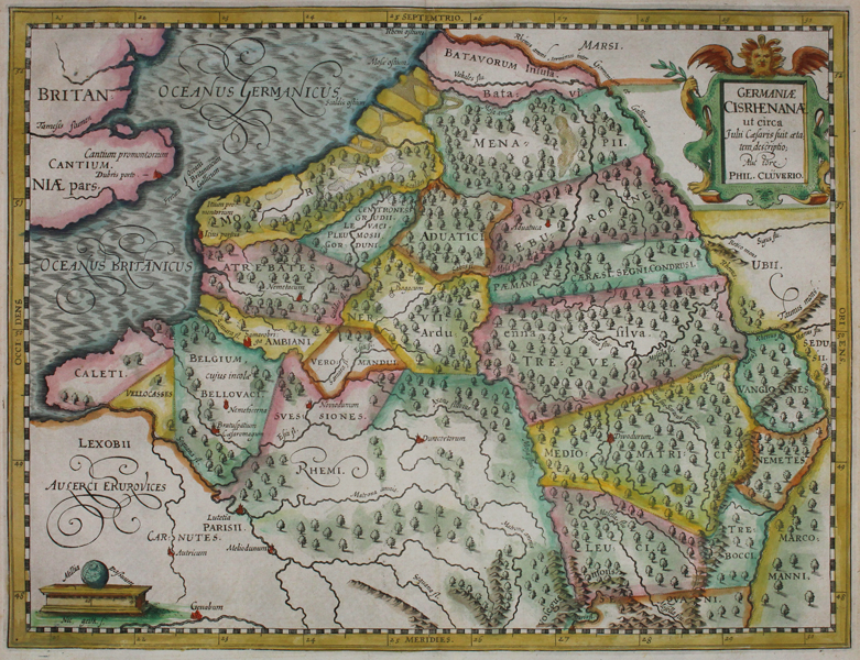
A map of ancient Germany, in the time of Julius Caesar. Map covers the German Empire to the west of the Rhine River and parts of Belgium and France. With the inclusion of trees and hill ranges. From 'Germaniae Antiquae Libri Tres', first published in 1631. Philip Cluver (1580-1622) was born in Danzig and after studying at Leyden and Oxford, he became interested in modern and historical geography. His subsequent publications made a wide and influential contribution to knowledge of the subject. Philip Cluver's "Introductonius" was a popular geography book, first published in 1624 without maps. There were many editions throughout the 17th and 18th centuries with maps from several sets of plates. Condition: Time toning and a couple of small tears to margins. One small hole to upper left corner. Central vertical crease, as issued. |
| Framing | unmounted |
| Price | £120.00 |
| Stock ID | 45727 |