
| Method | Steel engraved with original hand colour |
| Artist | Murchison, Roderick Impey |
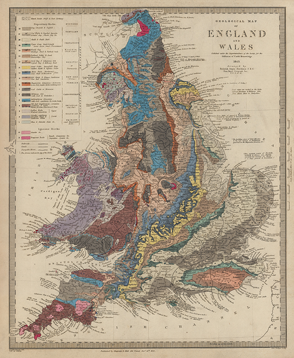
| Published | S. P. Woodward del. Cold. by T. Malby. J & C. Walker Sculp. Published by Chapman & Hall 186 Strand Decr. 15th 1843 |
| Dimensions | 380 x 310 mm |
| Notes |
An attractively coloured geological map of England and Wales, engraved by John and Charles Walker for the Society for the Diffusion of Useful Knowledge' (SDUK). The Map illustrates the geological bands, with each coloured by hand and corresponding to a colourcoded key in the top left. Unusually, the map's colourist is also named, credited under the draughtsman Woodward as a 'T. Malby.' Railroads, canals, and navigable rivers have also been illustrated. 'The Society for the Diffusion of Useful Knowledge' (SDUK), founded in 1826 and lasting only until 1848, was a Whiggish London organisation that published inexpensive texts intended to adapt scientific and similarly high-minded material for the rapidly expanding reading public. The Society's main purpose was to encourage universal literacy by publishing numbers of books of good quality that would be affordable to all. It was established mainly at the instigation of Lord Brougham with the objects of publishing information to people who were unable to obtain formal teaching, or who preferred self-education. Over 200 maps and plans were produced, first sold as part works on subscription and from 1844 in a variety of bound atlases. Sir Roderick Impey Murchison (1792–1871) was a British geologist who first described and investigated the Silurian system. Condition: Minor time toning and dirt staining to margins. Blank on verso. |
| Framing | unmounted |
| Price | £450.00 |
| Stock ID | 53475 |