
| Method | Steel engraved with original hand colour |
| Artist | Hacq, J.M. after Achin |
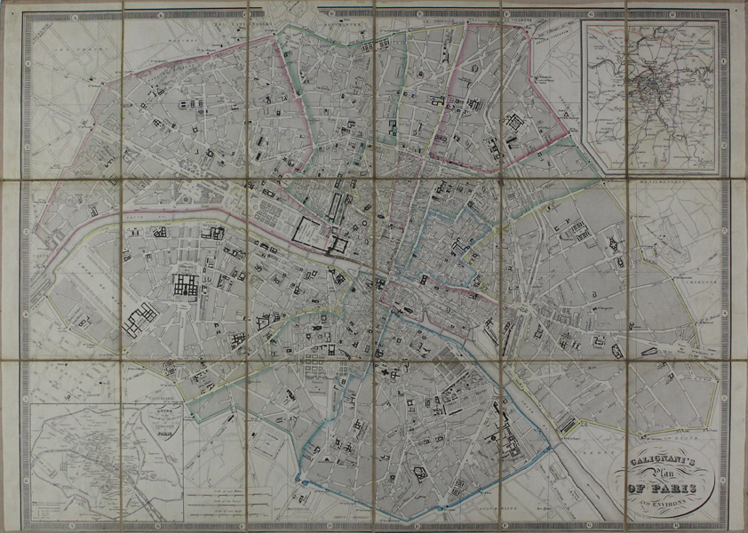
| Published | Drawn by Achin. Engraved by Hacq [Paris, c.1850] |
| Dimensions | 425 x 590 mm |
| Notes |
A folding tourist map of Paris, divided into 18 sections and laid to linen, produced by the famous Galignani publishing house. The map shows the Arrondissements of central Paris, outlined in original hand colour and captioned in English. In the top right corner, a smaller boxed inset shows the environs of Paris, while in the bottom left, another inset map provides a guide to the City's principal landmarks and attractions. This particular example features a pastedown label on the verso for Auguste Logerot's 'Atelier de Collage de Cartes Geographiques, Tableaux etc,' located at the Quai des Augustins 55 'Pres le Pont Neuf.' The Galignani publishing and bookselling empire was established by Giovanni Antonio Galignani (1757-1821), an Italian newspaper publisher, who, after some time in London, moved to Paris and established an English language newspaper called Galignani's Messenger. In addition to the paper, he opened an English Library, and ran language classes alongside his wife Anne Parsons. He was succeeded by his sons, John Anthony (1796-1873) and William (1798-1882), who expanded the business through reprints of English language books. The business also ran as a de facto club for English visitors in Paris, who paid for access to its extensive reading room. Condition: Dissected and laid to linen as issued. Pin holes to top corners. Some ageing to linen and edges of sheets, otherwise a fine clean example. |
| Framing | unmounted |
| Price | £200.00 |
| Stock ID | 47405 |