
| Method | Copper engraved |
| Artist | Scherer, Heinrich |
| Published | Augustae Vindel. Delingae & Francofurti, Apud Joannem Casparum Bencard, Bibliopolam. Anno MDCCX [Augsburg, 1710] |
| Dimensions | 225 x 350 mm |
| Notes |
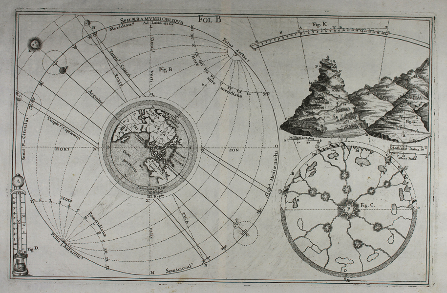
A collection of illustrations from the first book of Scherer's Atlas Novus Exhibens Orbem Terraqueum per Naturae Opera, also known as the Geographia Universa in Septem Partes Contracta. The largest of the three diagrams shows hours, meridians, horizons, and tropics of the globe. At centre is an oblique of the eastern hemisphere, centred on the Indian Ocean, featuring a truncated and partially mapped New Holland (Australia), and a very large New Guinea. The outer circle of the diagram contains the alchemic symbols of the zodiac, and four faces show the relative positions of suns and moons dependent on the seasonal tilt of the globe in its orbit. The second diagram shows methods of calculation for the heights of mountains, with scales in Italian miles. The final illustration, closely following Kircher, shows the subterranean connections of volcanoes. Heinrich Scherer (1628-1704) was a German cartographer, geographer, engraver, and publisher. A Professor of mathematics at Munich University, Scherer was also a devout Catholic, a facet of his life that is immediately apparent in his published works. His most famous publication was the Atlas Novus, an eight volume atlas produced between 1698 and 1710, which featured 187 plates depicting all of the known world, with particular reference to the activity of the Jesuit Order and the spread of Christianity around the world. Condition: Central vertical fold, as issued. Minor adhesive stains to bottom margin. Blank on verso. |
| Framing | unmounted |
| Price | £250.00 |
| Stock ID | 48358 |