
| Method | Copper engraved with hand colour |
| Artist | Delamarche, Charles François |
| Published | [Paris, 1806] |
| Dimensions | 200 x 235 mm |
| Notes |
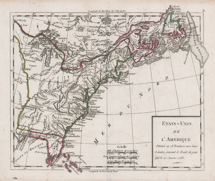
An early nineteenth century French map of the eastern seaboard of North America, showing the borders of the fledgling United States, from Delamarche's Atlas Elementaire, Compose de XXXIII Cartes. The map shows the divisions of the original 13 colonies, as well as the boundaries of British, French, and Spanish holdings in the continent following the Peace Treaty signed on the 20th of January 1783, a preliminary to the official Treaty of Paris which formally concluded the Revolutionary War. The borders of territories held by the colonial powers are outlined in hand colour, and the title is enclosed in a simple boxed cartouche in the bottom right of the map. Charles-François Delamarche (1740-1817) was a French cartographer, geographer, and publisher, best known for republishing and reissuing maps and atlases by his French forebears, Sanson, Vaugondy, and Bonne. His son Felix Delamarche was also a mapmaker and publisher of atlases and globes. Condition: Central vertical fold, as issued. Minor time toning to edges of sheet. Blank on verso. |
| Framing | unmounted |
| Price | £180.00 |
| Stock ID | 52152 |