
| Method | Woodcut |
| Artist | du Pinet, Antoine after Münster, Sebastian |
| Published | A Lyon, par Ian d'Ogerolles, MDLXIIII [Lyon, 1564] |
| Dimensions | 85 x 150 mm |
| Notes |
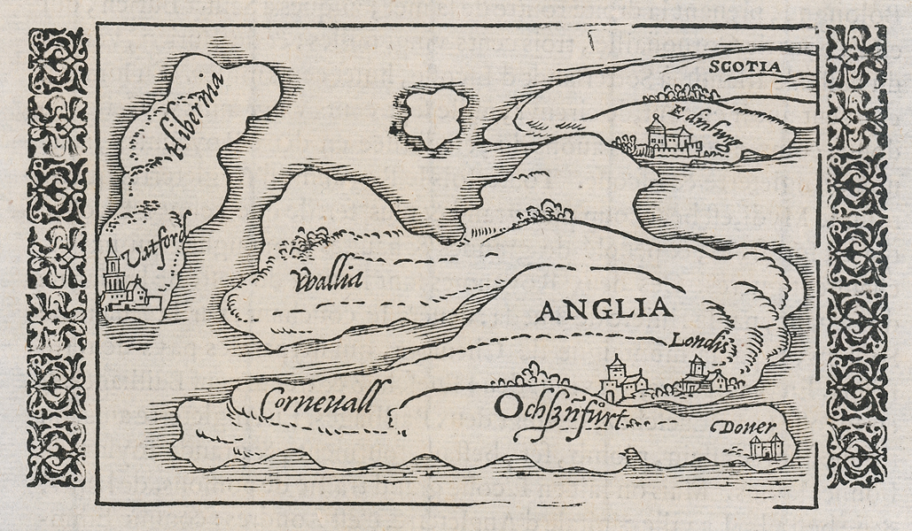
An early woodcut map of the British Isles, a very close copy of the block cut for Munster's celebrated Cosmographia. This particular example was used in Antoine du Pinet's exceptionally rare atlas, 'Plantz, Pourtraitz et Descriptions de Plusieurs villes et Forteresses, Tant de l'Europe, Asie, & Afrique, que des Indes, & Terres Newes.' The map is basic, and divides the islands into Hibernia (Ireland), Wallia (Wales), Corneuall (Cornwall), Scotia (Scotland), and Anglia (England). The cities of Edinburgh in Scotland, London, Oxford, and Dover in England, and Waterford in Ireland, are depicted as small settlements. Antoine du Pinet (1510-1584) was a French polymath, best known for his translations of Pliny and his works on botany, as well as atlases and travel narratives. Sebastian Münster (20th January 1488 - 26th May 1552) was a German cartographer, cosmographer, and theologian. A gifted scholar of Hebraic, Münster originally joined the Franciscans, but left the order in favour of the Lutheran Church. He was appointed to the University of Basel in 1529, and published a number of works in Latin, Greek, and Hebrew. His most celebrated works are his Latin edition of Ptolemy's Geographia in 1540, and the Cosmographia in 1544. The Cosmographia was the earliest German description of the world, an ambitious work of 6 volumes published in numerous editions in German, Latin, French, Italian, and Czech. Condition: Minor time toning to edges of sheet. Numerous repaired chips and tears to edges of sheet, not affecting map. Some splitting and paper thinning to text below map. French text above, below, and on verso. |
| Framing | unmounted |
| Price | £275.00 |
| Stock ID | 51986 |