
| Method | Copper engraved with hand colour |
| Artist | Russell, John Charles |
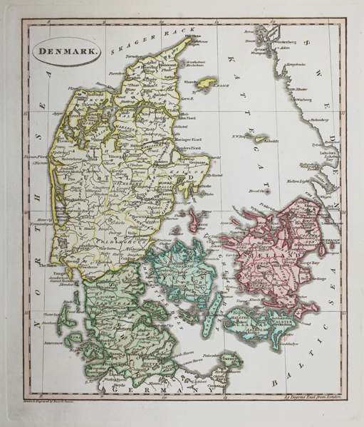
| Published | Drawn & Engraved by Russell Junior. [London, Thomas Ostell, c.1814] |
| Dimensions | 225 x 190 mm |
| Notes |
An early nineteenth century map of Denmark, in full hand colour, from Ostell's 'New General Atlas.' In the top right corner, the coastline of Sweden can be seen, while adjoining parts of Germany are included at bottom. The title is enclosed in a simple oval cartouche. John Charles Russell (1773-1848) was a British map engraver and print maker, the son of John Russell (c.1750-1829), who was also an engraver and cartographer. Despite publishing his own atlas, 'Russell's General Atlas of Modern Geography, he is best known for contributing map plates to the works of other cartographers, including Guthrie, Barlow, Guy, and Phillips. Condition: Crease to bottom right corner of sheet, not affecting map. Chips and time toning to edges of sheet. Blank on verso. |
| Framing | unmounted |
| Price | £45.00 |
| Stock ID | 50201 |