
| Method | Copper engraved with early hand colour |
| Artist | Keizer, Jacob |
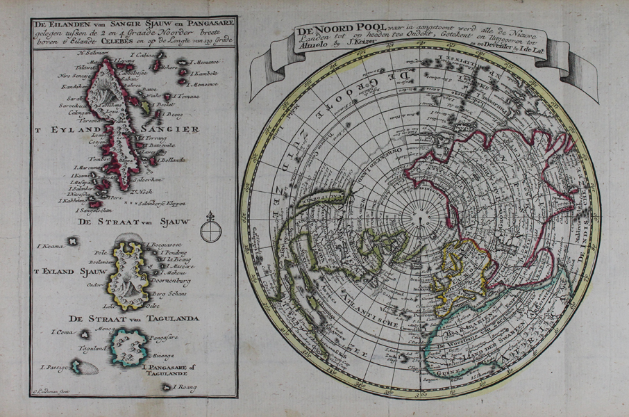
| Published | Getekent en Uitgegeven tot Almelo by J. Keizer en tot Deventer by I. de Lat [c.1747] |
| Dimensions | 180 x 270 mm |
| Notes |
A rare eighteenth century map of the North Pole, from Jan de Lat's bilingual French-Dutch Atlas Portatif-Weerelds Hand-Atlas. The map shows the continents of the Northern Hemisphere with the Arctic circle at centre. Much of the north western coast of North America is unmapped, and California is shown as an island. The continents are outlined in early hand colour, and a large inset boxed map on the left of the plate contains a detail of the Indonesian Sangihe Islands in North Sulawesi. Jacob Keizer (fl. 1706-1750), also Jacob Keyser, was a Dutch engraver and cartographer, about which little is known, apart from his being based in Almelo. Jan de Lat (fl. 1734-1750) was a Dutch publisher and printer, mostly known for his pocket atlases. Based in Deventer, he issued an Atlas Portatif in 1747, with maps engraved by Jacob Keizer. Condition: Vertical folds as issued. Time toning to sheet. Small tears to bottom of folds. Small repaired tear to left margin. |
| Framing | unmounted |
| Price | £300.00 |
| Stock ID | 47401 |