
| Method | Chromolithograph |
| Artist | May, J.E. |
| Published | Copyright by J.E. May. Agent for Advertisements in all Publications, 68 Fleet St. London E.C. [c.1910] |
| Dimensions | 500 x 695 mm |
| Notes |
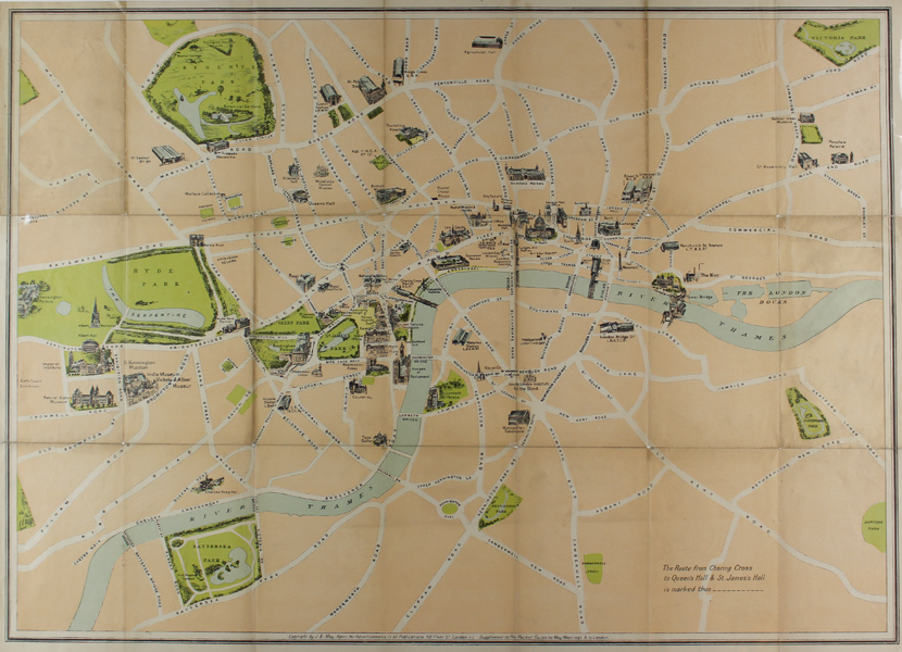
A large early twentieth century folding map of London, published by the advertising agent J.E. May to promote the concert season at the Queen's Hall and St James' Hall as a supplement to The Pocket Guide to May Meetings & to London. The map shows the City and Westminster, stretching from Kensington Palace in the west to Deptford Park in the east, and from Regents Park and Victoria Park in the north to Battersea Park and Camberwell Green in the south. The main landmarks of the capital are shown pictorially and the route from Charing Cross to the Concert Halls is marked by a dashed line which runs through Piccadilly Circus, up Regent Street, and through Langham Place to Great Portland Street. J.E. May (fl. c.1910) was a British advertising agent and publisher, whose offices were located on Fleet St. Condition: Vertical and horizontal folds, as issued. Time toning and splitting to folds. Surface dirt to top right and centre and bottom left panels of map. |
| Framing | unmounted |
| Price | £225.00 |
| Stock ID | 50617 |