
| Method | Lithograph with original hand colour |
| Artist | Weller, Edward |
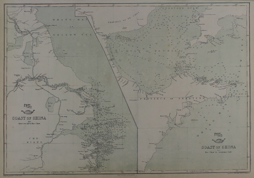
| Published | Weekly Dispatch Atlas. 139 Fleet Street. Day & Son Lithrs. to The Queen. Engraved by Edwd. Weller, Duke Str. Bloomsbury. [London. 1863] |
| Dimensions | 305 x 425 mm |
| Notes |
A pair of lithographed maps on the same plate, showing the coastlines of China, from The Weekly Dispatch Atlas. The map covers China's northeastern coast, split across the two maps. On the left is the coast from the Chusan Archipelago (modern Zhoushan, south of Shanghai) to Hae-Chow (near modern Qingdao). The right hand map continues up the coast, encompassing the Shandong peninsula, the Gulf of Pechili (the Bay of Bohai), and the southern part of the Liaodong Peninsula. In the top left of the second map, Pekin (Beijing) is included. Between 1857 and 1863, the British newspaper The Weekly Dispatch published a series of maps. Over 100 maps were produced, and in 1863, the maps were gathered together to form The Dispatch Atlas. The atlas contained county and country maps, as well as several city maps. Each of the maps featured a distinctive image of a half-globe with a winged mercury above. Edward Weller, FRGS (d.1884) was an engraver, publisher and cartographer. He had premises in London at 34, Red Lion Square (1861) and Duke Street, Bloomsbury (1872). He often worked for George Philip and Son, and William Collins, Sons, & Co. Many of his maps were included in student atlases. Weller's business was continued by his wife Mary Anne (d.1887) and his son Francis Sidney (d.1910). Condition: Vertical and horizontal folds. Minor time toning to edges of sheet. Blank on verso. |
| Framing | unmounted |
| Price | £95.00 |
| Stock ID | 48705 |