
| Method | Copper engraved with original hand colour |
| Artist | Stieler, Adolf |
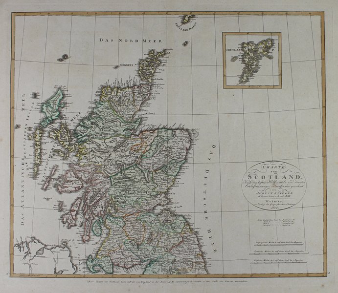
| Published | von August Stieler K. Preuss Lieut v.d. reit. Artill. Weimar im Verlage des Geographischen Instituts. 1804 |
| Dimensions | 450 x 535 mm |
| Notes |
A large and detailed early nineteenth century German map of Scotland, engraved by Stieler for the Geographical Institute of Weimar. The map shows the whole of the country, divided up into its historic shires and ornamented in full original wash colour. The southern part of the Shetland Islands is just visible along the top border, so a separate inset boxed map of the whole archipelago is included at top right. The title is enclosed in a simple oval cartouche at bottom right, above a scale in German, Scottish, and English miles. Curiously, Stieler's name is misprinted as 'August' rather than 'Adolf'. Adolf Stieler (1775-1836) was a German geographer, banker, and lawyer. In addition to a long career as legal counsel to the local government of Gotha, Stieler had a prolific cartographic career, serving first in the Weimar Geographical Institute before publishing his own Handatlas, a publication which proved to be one of the most popular and enduring of German geographical publications, running to numerous editions and remaining in print until the mid twentieth century. Condition: Central vertical fold, as issued. Minor time toning to margins. Printers crease to right hand side of bottom margin, into plate. Manuscript 'XXVII' to verso, otherwise blank. |
| Framing | unmounted |
| Price | £250.00 |
| Stock ID | 50655 |