
| Method | Copper engraved with hand colour |
| Artist | Bellin, Jacques Nicolas |
| Published | [Paris, c. 1764] |
| Dimensions | 225 x 345 mm |
| Notes |
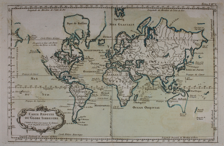
A map of of the world, from Jacques Nicolas Bellin's 'Le Petit Atlas Maritime Recueti de Cartes et Plans des Quatre Parlies du Monde en Cinq Volumes', first published in Paris in 1764. The map shows Australia and New Zealand on the eve of voyages of Captain James Cook, which would substantially advance the European knowledge of the Coastal Regions. The Bay of the West is shown, with limited speculation on the Northwest Passage. The areas visited by the Russians along the coastline of the modern British Columbia are noted. Jacques Nicolas Bellin (1703-1772) was a Paris-born geographer, he was hydrographer of the French Navy, member of the Académie de Marine and of the Royal Society of London, and part of the French intellectual group the Philosophes. He produced a large number of individual maps of particular interest to the Ministère de la Marine. His maps of Canada and of French territories in North America (New France, Acadia, Louisiana) are particularly valuable, as he produced them to reflect the ongoing discoveries in these regions. Bellin was appointed hydrographer to the king in 1741 and would eventually retire and die at Versailles. His most impressive work was "Le Petit Atlas Maritime" in which he compiled an overview of all the coastlines, ports and harbour cities of the known world at the time, with no less than 581 maps. Condition: Time toning, some foxing and surface dirt. Central vertical fold, as issued. |
| Framing | unmounted |
| Price | £275.00 |
| Stock ID | 45374 |