
| Method | Copper engraved with hand colour |
| Artist | Zannoni, Giovanni Antonio Bartolomeo Rizzi |
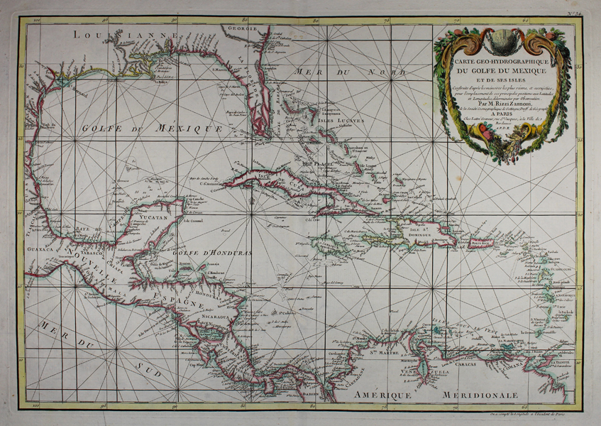
| Published | Par M. Rizzi Zannoni de la Societe Cosmographique de Gottingue, Proff. de Geograph. A Paris. Chez Lattre Graveur, rue St Jacques, a la Ville de Bordeaux. A.P.D.R. [Paris, c.1783] |
| Dimensions | 315 x 450 mm |
| Notes |
An eighteenth century French map of the West Indies, and adjoining parts of what is now the southern United States, Mexico, Central America, and the northern coast of South America, engraved by Zannoni and issued by Jean Lattre in his Atlas Moderne ou Collection de Cartes sur Toutes les Parties du Globe Terrestre, a composite atlas with plates engraved by Zannoni, Bonne, Janvier, Delamarche, and Lattre himself. The map is outlined in hand colour, and ornamented with a large title cartouche in the top right corner. Giovanni Antonio Bartolomeo Rizzi Zannoni (1736-1814) was an Italian cartographer and map engraver, whose career was, for the era, quite peripatetic. Although beginning and ending his career in Italy, he carried out the first survey of Poland to be done via triangulation, was similarly employed in Sweden and Denmark, and served the Prussians in the Seven Years War. In this latter role, he was captured by the French and sent to Paris, where he lived and worked for twenty years, being elevated to the position of Hydrographic Engineer. He returned to his birthplace of Padua in 1776, and spent the rest of his life in the Kingdom of Naples, working on the famous 'Geographic Atlas of the Kingdom of Naples.' Jean Lattre (fl. 1743 - 1793) was an engraver, bookseller and map publisher who was active in Paris from the mid until late 18th century. He worked with French, Italian and English cartographers like Santini, Delamarche, Bonne and Faden. Condition: Central vertical fold, as issued. Blank on verso. |
| Framing | unmounted |
| Price | £400.00 |
| Stock ID | 48472 |