
| Method | Copper engraved with hand colour |
| Artist | van Loon, Harmanus |
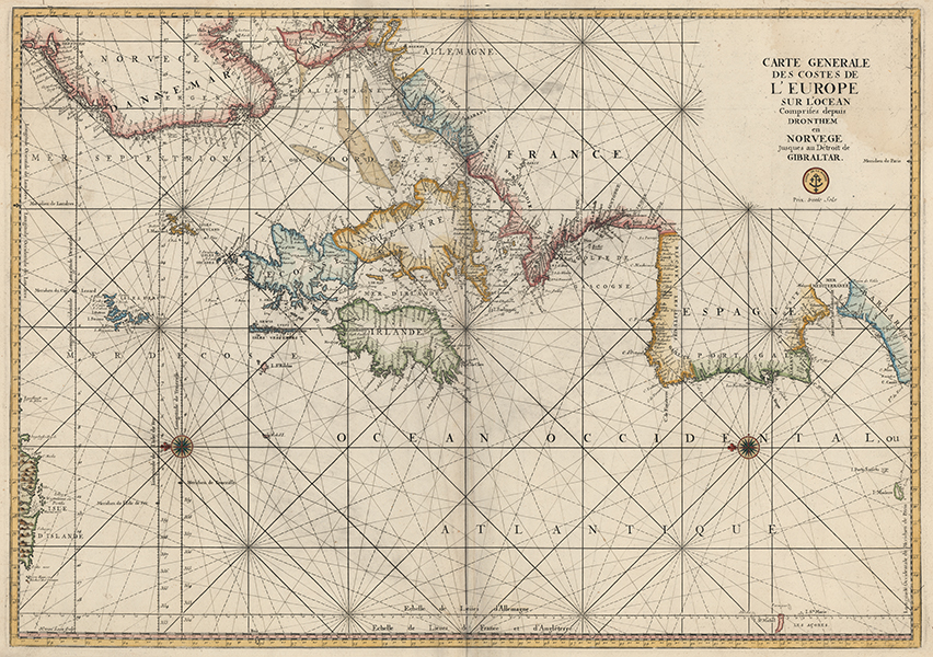
| Published | H. van Loon sculp. Depot de la Marine. Prix trente Sols. [Paris, c.1774] |
| Dimensions | 600 x 855 mm |
| Notes |
A large and impressive sea chart of the northern Atlantic coasts of Europe, oriented with east to top, engraved by Harmanus van Loon for Charles Pene's important maritime atlas, Le Neptune François. The map, one of the largest and most visually striking in the series, encompasses the coasts of the southern parts of Iceland and Norway, Denmark, the Netherlands, Belgium, France, Spain, northern Morocco, the British Isles, Madeira, and the Azores. The current example was first issued in 1693 by order of Louis XIV. Subsequent issues, as here, feature the anchor and triple fleur-de-lis badge of the Depot de la Marine, formed in 1720 to collect maps, plans, and charts of use to the French Navy. By 1773 it had gained a monopoly over the creation, printing, and distribution of French sea-charts. Pirated editions of many of the charts from Le Neptune François were issued in Amsterdam by Jaillot and Mortier. Harmanus van Loon (fl.1690-1725) was a Flemish engraver and mapmaker, about whom very little is known. Signing his work H. van Loon, he engraved plates for many of the leading French cartographers of the era, including Delisle, de Fer, and Nolin. Condition: Central vertical fold, as issued. Creasing to right and left of central fold. Minor time toning and creasing to margins. Watermarked date '1774.' Blank on verso. |
| Framing | unmounted |
| Price | £950.00 |
| Stock ID | 53418 |