
| Method | Steel engraved |
| Artist | Findlay, Alexander |
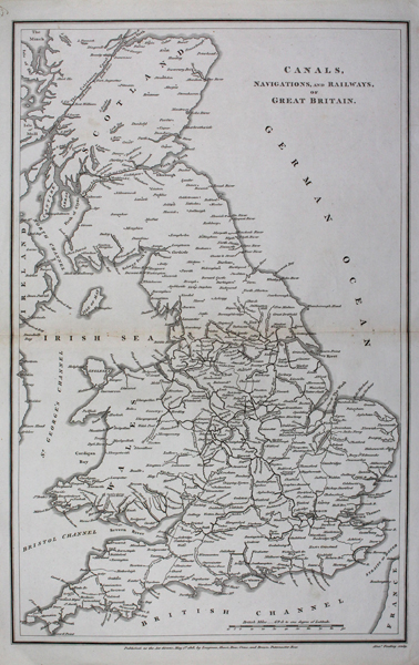
| Published | Published as the Act directs, May 1st 1818, by Longman, Hurst, Rees, Orme, and Brown, Paternoster Row. [c. 1820] |
| Dimensions | 395 x 248 mm |
| Notes |
A detailed map of the British Isles, featuring major cities, rivers and canals. From Abraham Rees's 'Cyclopedia; or Universal Dictionary of Arts, Sciences and Literature' an important 19th Century encyclopaedia which was regarded by some as subversive when it first appeared. It was compiled by John Wilkes (1750-1810, of Milland House, Sussex) and edited by Revd. Abraham Rees (1743–1825). The majority of the engravings were produced by Syd Edwards and by engravers such as Wilson Lowry & John Farey, Jr.& J. Scott. Alexander Findlay (1790-1870) was an English geographer and one of the original fellows of the Royal Geographical Society. He was the father of Alexander George Findley (1812-1875) who would become an important geographer and hydrographer. Condition: Pressed centre fold, as issued. Light staining to centre fold. |
| Framing | unmounted |
| Price | £85.00 |
| Stock ID | 43128 |