
| Method | Steel engraved |
| Artist | Moule, Thomas |
| Published | [c. 1840] |
| Dimensions | 230 x 135 mm |
| Notes |
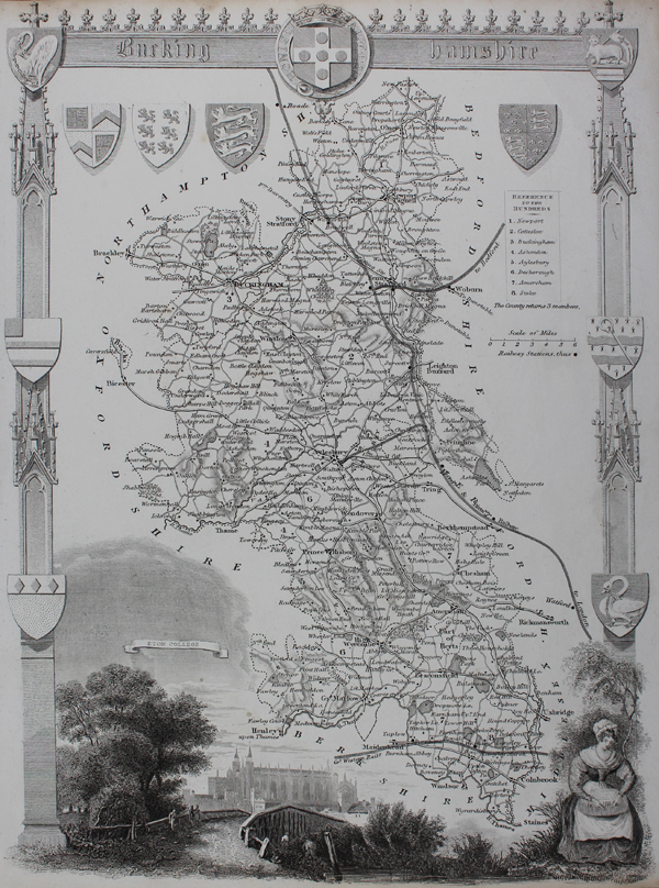
A decorative map of the county of Buckinghamshire. The map shows the borders of Hundreds, principal towns and villages, and the railways. A large vignette along the bottom of the map shows a view of Eton. The map is enclosed in a typical ornamental border featuring numerous crests and armorials. Thomas Moule (1784-1851) was a British writer, engraver, cartographer, and antiquarian. Originally a writer on Heraldry and general antiquities, Moule was born in Marylebone, London. From around 1816 to 1823 he was a bookseller, from his shop in Grosvenor Square, London. He then became an inspector of letters in the General Post Office, where his responsibilities included trying to 'read' illegible hand writing. His highly decorative series of county maps were first published in separate issues for each county between 1830 and 1832. In 1836 these were brought together in one work, by George Virtue & Co. They continued to appear in Rev. Barclay's Dictionary into the 1840's. Condition: Trimmed close to border of map as issued. Time toning to edges of sheet. Blank on verso. |
| Framing | unmounted |
| Price | £65.00 |
| Stock ID | 49114 |