
| Method | Chromolithograph |
| Artist | George Philip & Son Ltd. |
| Published | The London Geographical Institute, 1921 |
| Dimensions | Each sheet 367 x 290 mm, Whole map 1097 x 883 mm |
| Notes |
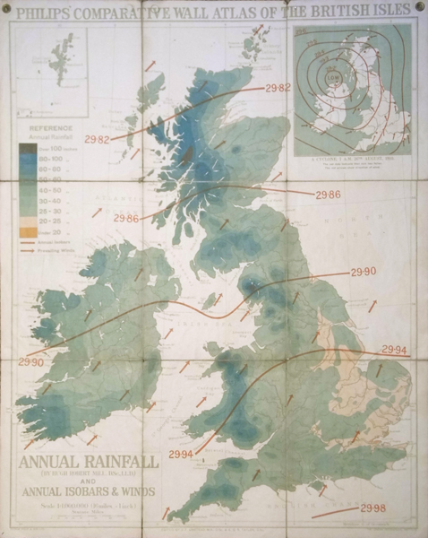
A large folding wall map of Britain dissected into nine sheet and laid to linen. This map shows the annual rainfall across Great Britain with a reference in the top left indicating rainfall in inches and a key outlining annual isobars and prevailing winds. In the top right hand corner shows a cyclone from 20th August 1910. The scale of this map is 16 miles to 1 inch. Condition: Small tears to bottom and side folds. Light dirt build up to sheet. Includes the original eye holes for hanging. London County Council library stamp on the verso. |
| Framing | unmounted |
| Price | £275.00 |
| Stock ID | 36113 |