
| Method | Lithograph with original hand colour |
| Artist | Weller, Edward |
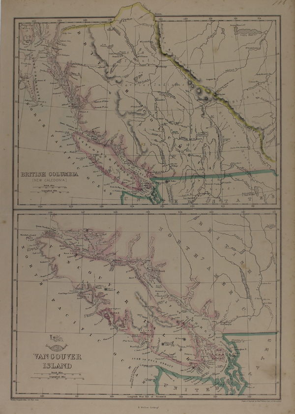
| Published | Weekly Dispatch Atlas, 139 Fleet Street. E.Weller Lithogr. Drawn & Engraved by Edwd. Weller. Duke Strt. Bloomsbury [London, c.1863] |
| Dimensions | 445 x 302 mm |
| Notes |
A pair of lithographed maps on the same plate, showing British Columbia and Vancouver Island, from The Weekly Dispatch Atlas. Coastlines are outlined in original hand colour, as are the neighbouring borders of the United States. The San Juan archipelago, the source of a border dispute between the United States and the British Crown, are here shown as part of British Canadian territory. Between 1857 and 1863, the British newspaper The Weekly Dispatch published a series of maps. Over 100 maps were produced, and in 1863, the maps were gathered together to form The Dispatch Atlas. The atlas contained county and country maps, as well as several city maps. Each of the maps featured a distinctive image of a half-globe with a winged mercury above. Edward Weller, FRGS (d.1884) was an engraver, publisher and cartographer. He had premises in London at 34, Red Lion Square (1861) and Duke Street, Bloomsbury (1872). He often worked for George Philip and Son, and William Collins, Sons, & Co. Many of his maps were included in student atlases. Weller's business was continued by his wife Mary Anne (d.1887) and his son Francis Sidney (d.1910). Condition: Minor tears and time toning to edges of sheet. Blank on verso. |
| Framing | unmounted |
| Price | £100.00 |
| Stock ID | 48619 |