
| Method | Copper engraved |
| Artist | Cole, Benjamin |
| Published | London: Printed for T. Osborne and J. Shipton, in Gray's-Inn; and J. Hodges, near London-Bridge, 1756. |
| Dimensions | 227 x 358 mm |
| Notes |
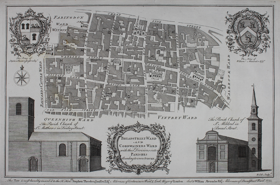
A map of Breadstreet Ward and Cordwainers Ward from William Maitland's The History and Survey of London from it's Foundation to the Present Time with vignettes of the arms of Stephen Theodore Janssen, the arms of William Alexander, St. Mattew's in Friday Street, and St. Mildred in Bread Street. Benjamin Cole (1697-1783) was an English printmaker, who engraved, printed and sold prints from his shop at St Paul's Church in London. He also produced a wide variety of book illustrations, and is not to be confused with the near contemporary map engraver of the same name (1667-1729), who was active in Oxford. |
| Framing | unmounted |
| Price | £100.00 |
| Stock ID | 49936 |